Peterhead to Glencoe: Jim Horne's Two-Day Highland Loop
Two days and 697 km from the north-east coast to Glencoe and back, by Loch Tay, Rannoch Moor, Fort William and Speyside. It's a route Jim Horne rides and recommends, with a night in Tyndrum in the middle.
The coast, the lochs, Glencoe and whisky country
Distances and climbing are measured from the GPX. Allow a full day for each half; stops for photos, food and fuel add up quickly.
Android and the file opens as text? Download the ZIP version instead and open it in your Files app to extract the GPX.
Elevation profile
This is the second route from my friend and Cannonball legend Jim Horne in Real Riders, Real Routes. His first, the Peterhead Whisky Loop, is a big day out. This one goes further west, right across Scotland to Glencoe, with a night in Tyndrum. Read Jim's full interview for his story.
Day 1: Peterhead to Tyndrum
Day 1 leaves Peterhead on the A975 by Cruden Bay, then heads inland through Newmachar and Kintore to Banchory. From there the Slug Road (A957) runs over the hill to Stonehaven. The A92 follows the coast south through Inverbervie and Gourdon to Montrose, then the route turns west through Forfar and Kirriemuir and across the Strathmore farmland to Dunkeld.
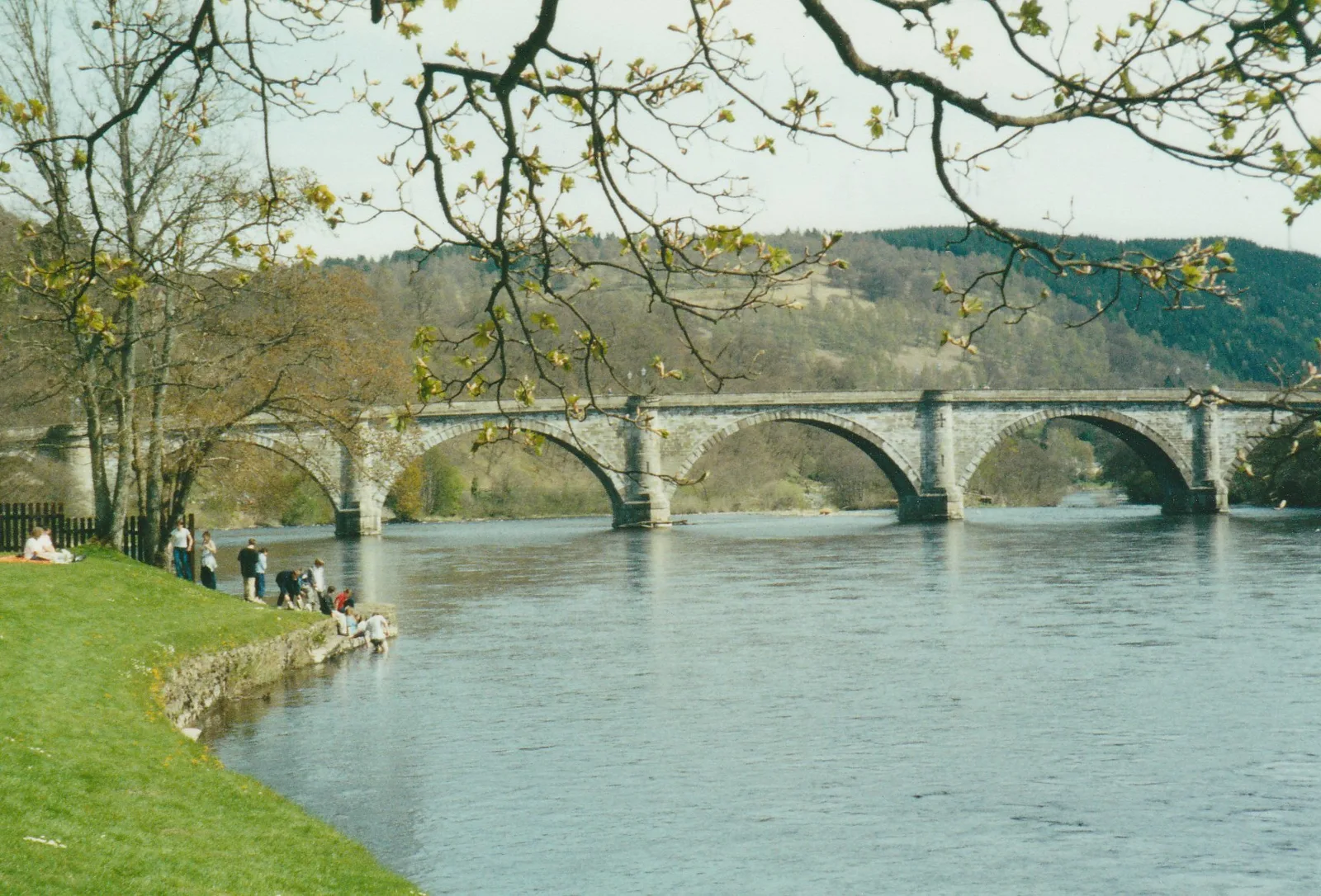
Dunkeld Bridge over the River TayPhoto: peter robinson, CC BY-SA 2.0, via Wikimedia Commons
Loch Tay and the Falls of Dochart
From Dunkeld the road follows the Tay through Logierait to Aberfeldy and Kenmore. Instead of the main A827, the GPX takes the narrow south Loch Tay road through Acharn and Ardeonaig. It's single track in places and slow, but quiet, with the loch beside you most of the way. Watch for oncoming cars at the blind crests.
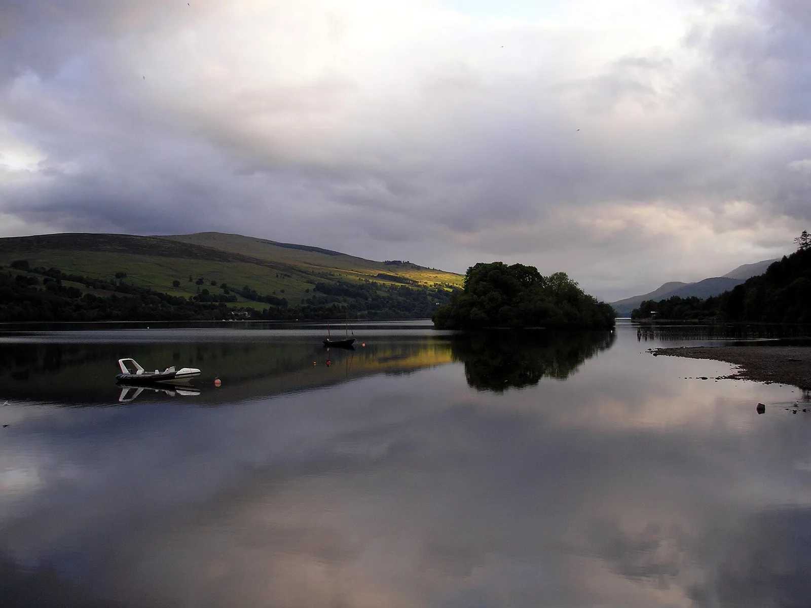
Loch Tay from Kenmore, where the south shore road beginsPhoto: Keith S Brown, CC BY-SA 3.0, via Wikimedia Commons
At the west end of the loch is Killin, where the River Dochart pours over the rocks right next to the bridge in the village. There's parking nearby and it's worth ten minutes off the bike.
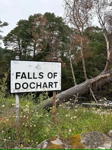
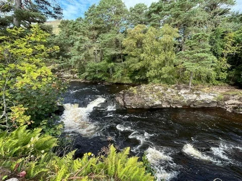
Jim's photos from the Falls of Dochart
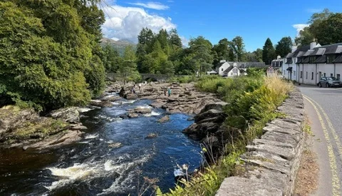
Killin and the River Dochart
The last stretch runs up Glen Dochart on the A85 to Crianlarich and on to Tyndrum, the overnight stop.
The Green Welly Stop, Tyndrum
The Green Welly Stop on the A82 is a well-known meeting place for bikers, with fuel, a restaurant, a snack stop and a bike park with space for up to 50 bikes. Fuel is open from 7am to 10pm. The family-run business has been put up for sale after 61 years, but it is trading as normal, so check opening times before you rely on it.
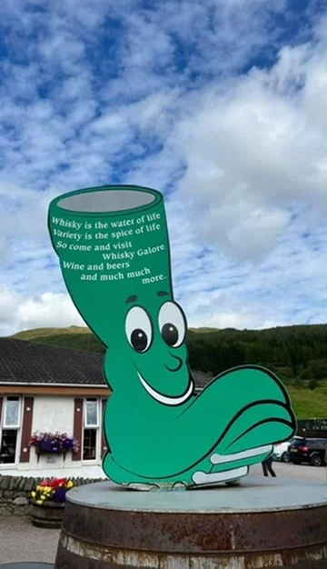
The famous boot at the Green Welly Stop
Detour: Cultybraggan PoW Camp
Cultybraggan Camp near Comrie is Scotland's only surviving Second World War prisoner-of-war camp, with its Nissen huts still standing. It's about 19 km off the route from Lochearnhead by St Fillans and Loch Earn. The museum opens April to October, Thursday to Monday, 10am to 4pm, with entry by donation, and there's a café on site.
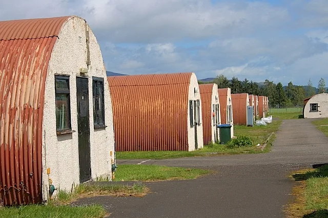
Nissen huts at Cultybraggan Camp (Camp 21)Photo: Mick Garratt, CC BY-SA 2.0, via Wikimedia Commons
Detour: Inveraray and the Clyde puffer
If you arrive in Tyndrum early, there's a fine road down to Inveraray. Take the A85 to Dalmally, then the A819 past Loch Awe, about 40 km each way. At Inveraray pier you'll find the Vital Spark, a 1944 Clyde puffer named after the boat in Neil Munro's Para Handy stories.
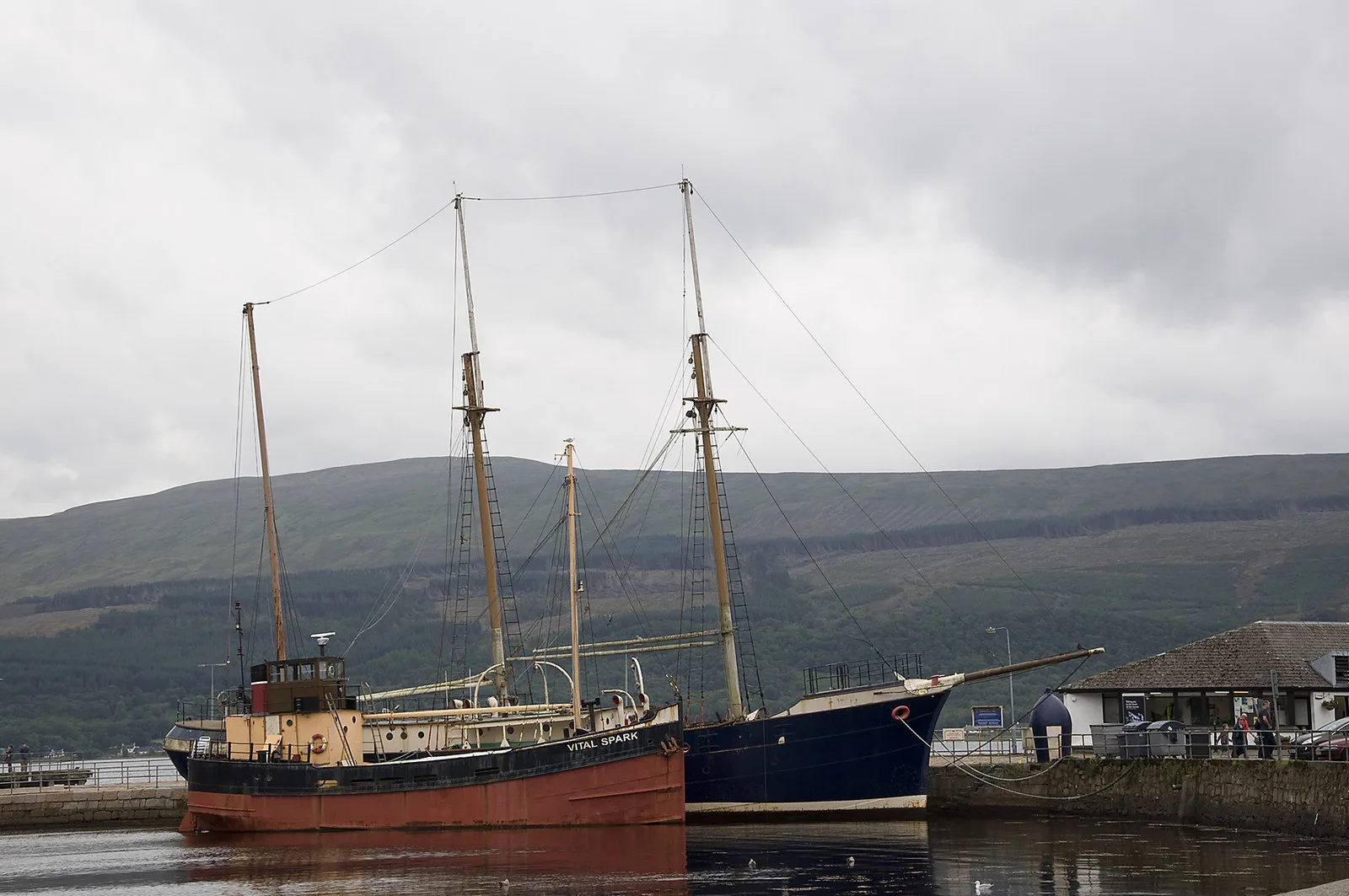
The Vital Spark at InverarayPhoto: Stuart Wilding, CC BY-SA 2.0, via Wikimedia Commons
Where to stay in Tyndrum
Hotel links on this page are affiliate links. If you book through them, I may earn a small commission at no extra cost to you.
Muthu Ben Doran Hotel
Tyndrum, FK20 8RZ · on the route
Jim stays here on this route. It's a 3-star hotel with a large free private car park on site.
Check prices on Booking.comDay 2: Tyndrum to Peterhead
Rannoch Moor and Glencoe
Day 2 starts with the best bit. The A82 climbs from Tyndrum to Bridge of Orchy and across Rannoch Moor, then drops past Buachaille Etive Mòr into Glencoe. It's one of the great roads in Britain, so stop at the lay-bys for photos, not on the road.
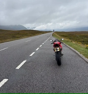
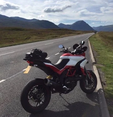
Jim's Ducatis on the A82 towards Glencoe: his Streetfighter and his Multistrada
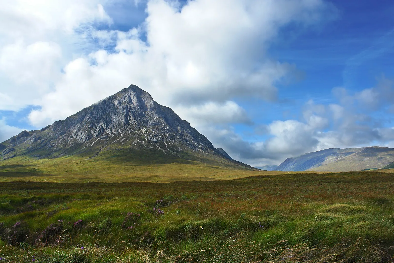
Buachaille Etive Mòr, the gateway to GlencoePhoto: MJ Mac, CC BY 2.0, via Wikimedia Commons
Fort William, Spean Bridge and Laggan
From Glencoe the route crosses the Ballachulish bridge and runs up Loch Linnhe to Fort William, a good place for fuel and food. Just past Spean Bridge is the Commando Memorial, where the Commandos who trained in this area during the Second World War are remembered, with Ben Nevis behind.
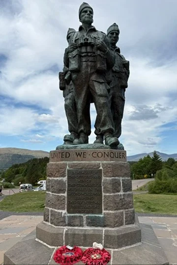
The Commando Memorial, Spean Bridge
The A86 then runs east along Loch Laggan, past the Laggan Dam hydro scheme and over to Newtonmore and Kingussie. It's a fast, flowing road with big views.
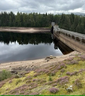
Laggan Dam, part of the Lochaber hydro scheme
Speyside and home
From Aviemore the route goes by Nethy Bridge and over the hill road at Bridge of Brown, just north of Tomintoul, then down Glenlivet to Dufftown in the heart of whisky country. From there it's Keith, then quiet roads through Fyvie, Oldmeldrum and Ellon back to Peterhead.
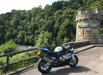
The Old Craigellachie Bridge, ten minutes from the Macallan distillery
Detours: Craigellachie and the Lecht
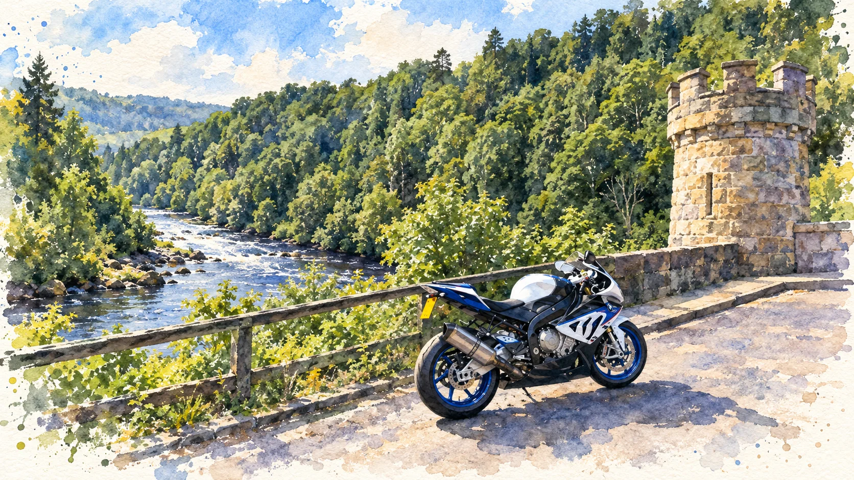
Thomas Telford's Old Craigellachie Bridge, the one in the watercolour at the top, is about 6 km north of Dufftown. For a longer detour, the Lecht road over to Cock Bridge starts in Tomintoul, a few kilometres off the route.
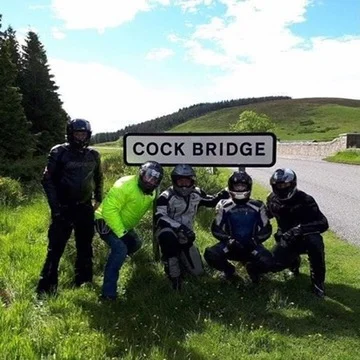
Jim and friends at Cock Bridge on the Lecht road. That's me in the yellow waterproof; it rained a lot on that trip
What's in the GPX
One GPX track for the whole loop, made in Kurviger. It works with Garmin, TomTom, Calimoto, OsmAnd and most other navigation apps. If your device prefers shorter files, split it at Tyndrum. Check the route in your app before you ride. These are the main stops along the way:
| # | Stop | Day | Why stop |
|---|---|---|---|
| 1 | Peterhead | Day 1 | Start and finish on the north-east coast |
| 2 | Stonehaven | Day 1 | Down the Slug Road to the harbour town |
| 3 | Montrose | Day 1 | The A92 coast road south through Gourdon |
| 4 | Forfar | Day 1 | West across Angus towards the hills |
| 5 | Dunkeld | Day 1 | Telford's bridge over the Tay |
| 6 | Aberfeldy | Day 1 | Into Highland Perthshire |
| 7 | Kenmore | Day 1 | The quiet south Loch Tay road starts here |
| 8 | Killin | Day 1 | Falls of Dochart, right by the road |
| 9 | Tyndrum | Day 1 | Overnight stop and the Green Welly |
| 10 | Bridge of Orchy | Day 2 | Up onto Rannoch Moor on the A82 |
| 11 | Glencoe | Day 2 | Buachaille Etive Mòr and the glen |
| 12 | Fort William | Day 2 | Fuel and food under Ben Nevis |
| 13 | Commando Memorial | Day 2 | Spean Bridge, with views to Ben Nevis |
| 14 | Laggan Dam | Day 2 | The A86 along Loch Laggan |
| 15 | Aviemore | Day 2 | Through Strathspey via Newtonmore and Kingussie |
| 16 | Bridge of Brown | Day 2 | Hill road just north of Tomintoul |
| 17 | Dufftown | Day 2 | Speyside whisky country |
| 18 | Keith | Day 2 | East through the farmland of Moray |
| 19 | Ellon | Day 2 | The last run home to Peterhead |
Before You Go
- Remember to lock your bike overnight if there's no secure parking available.
- The south Loch Tay road is narrow and single track in places. Use the passing places and watch for oncoming traffic.
- The A82 through Glencoe is busy with coaches and camper vans in summer. Start early on Day 2.
- Watch for deer, sheep and gravel, and check the weather on Rannoch Moor. It can change fast.
Android and the file opens as text? Download the ZIP version instead and open it in your Files app to extract the GPX.
Want a route like this built for you?
Tell me where you want to ride, how many days you have and the places you want to see. I'll plan your own route with special stops, route notes and GPX files.
Plan my custom route