The Grand Alpine Traverse
1,234 km from the Gotthard cobbles to a St Moritz hotel car park — twenty-two named passes across Switzerland, Austria and Italy, 20,660 metres of climbing, and a high point of 2,757 metres on the Stelvio.
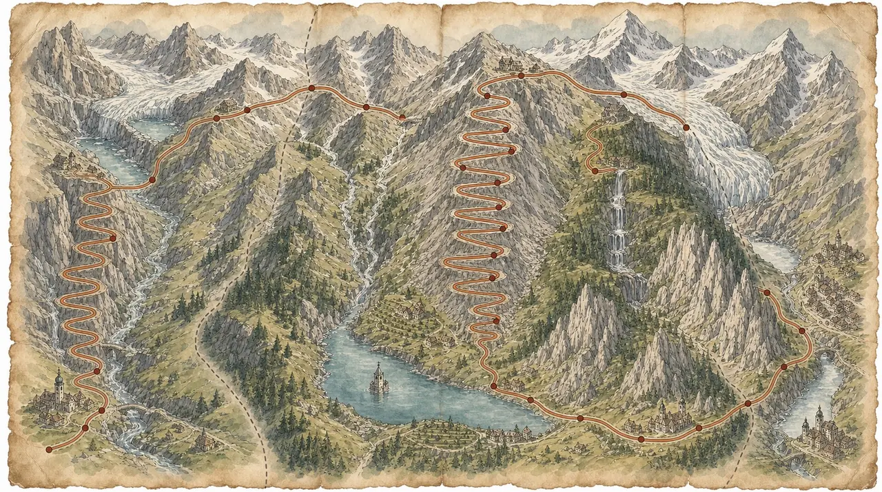
1,234 km, twenty-two passes, four days, three countries
Start on the cobbles of the Tremola below Airolo. Finish four days later on a lakeside street in St Moritz. In between: the Furka and the Grimsel back to back, the Susten in both directions, the Engadine, the Stelvio from the Swiss side, the Reschensee bell tower, the Zillertal, the Grossglockner before breakfast, the Giau, the Sella Ronda, the Gavia, duty-free fuel in Livigno and the Bernina to bring you home. Twenty thousand six hundred metres of climbing. This is the big one.
"Furka and Grimsel before the first coffee. The Stelvio on day two. The Grossglockner on day three. The Gavia on day four. There is no filler in this route — only the bits where you catch your breath."
— Alan Jones, on the Grand Alpine TraverseElevation profile
How it rides
One thousand two hundred and thirty-four kilometres. Twenty thousand six hundred and sixty metres of climbing. Twenty-two named passes, three countries, and a high point of 2,757 metres on the Stelvio. The lowest the route ever gets is 201 metres on the floor of the Adige valley, which means the profile does not so much undulate as saw.
There is no motorway on this route worth mentioning and almost no straight road. It is four days of second and third gear, of counting hairpins, of watching your mirrors for something faster and your front tyre for something slower. On a good day you will average forty-five kilometres an hour and be perfectly happy about it.
Treat all of it as a menu rather than a timetable. The GPX is one continuous line because that is how it was ridden, but there is no prize for completing it. Take the two passes you came for and go home, or take the lot over a week. It works either way.
Four days is the honest minimum and it is a hard four days — six to nine hours of moving time each, before you have stopped for a photograph. If you have a fifth day, take it. The natural split is at Bormio, and I will come back to that at the end.
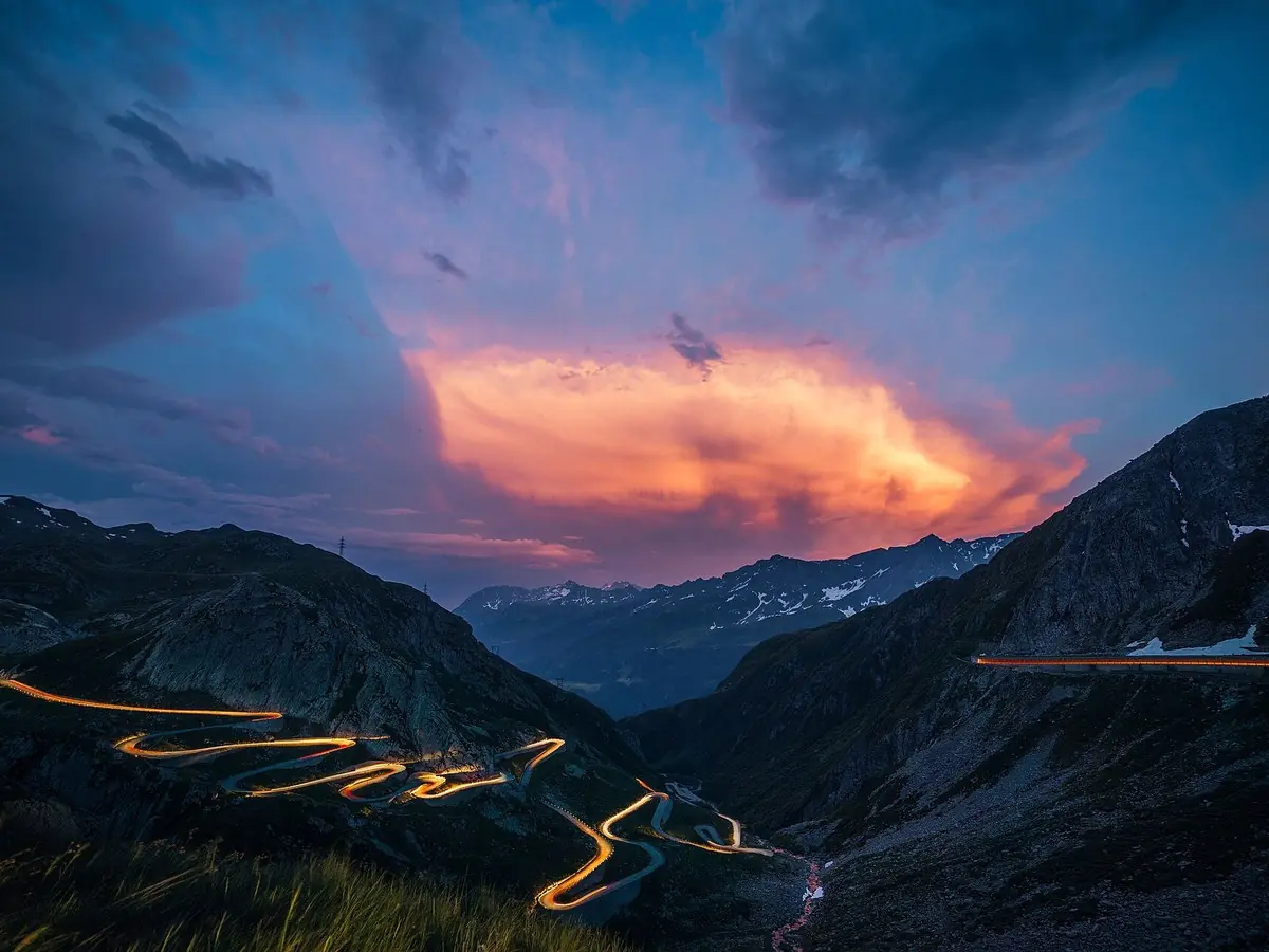
The Tremola above Airolo — km 0, and the route starts on cobbles. Gentle with the throttle.Photo: Samuel Ferrara · CC BY-SA 4.0

The stages at a glance
Day 1 — Airolo to Davos. 283 km, +5,927 m. Gotthard, Furka, Grimsel, Susten, Oberalp, Wolfgang. Six passes and the biggest single day of climbing outside the last one.
Day 2 — Davos to Innsbruck. 262 km, +3,848 m. Flüela, Ofen, Umbrail, Stelvio, Reschen. The shortest day on paper and the one you will remember longest.
Day 3 — Innsbruck to Cortina d'Ampezzo. 315 km, +4,022 m. Gerlos and the Grossglockner, then the long run down the Drau and the Puster valley into the Dolomites.
Day 4 — Cortina to St Moritz. 374 km, +6,821 m. Giau, Campolongo, Gardena, Sella, then the drop to the Adige, back up over the Tonale, the Gavia, Foscagno, Eira, Forcola and the Bernina. This is the monster.
Day one — the classics, back to back, km 0–283
The start is on cobbles, which is a statement of intent. The Tremola — the old Gotthard road above Airolo — is a stack of cobbled hairpins climbing to the Gotthard Pass at 2,106 m by km 14. It is a museum piece you can ride, and it is genuinely slippery when damp. Fill up in Airolo before you start; there is nothing on the mountain.
Down into Hospental, then straight up the Furka Pass, 2,429 m at km 40. Wide, fast, open, and the highest point of the day. This is the Goldfinger road, and the car park at the top is full of people who have come to look at it rather than ride it. Just below the summit on the west side the road drops into the hairpin bowl at Gletsch, where the Rhone begins. The Belvedere road up to the ice grotto is a five-minute detour and it is the only place on this route where you can put a hand on a glacier.
From Gletsch the road climbs straight back out over the Grimsel Pass, 2,164 m at km 57 — dam walls, black rock, green reservoirs, and a completely different character to the Furka despite being fifteen kilometres away from it. Then the long descent past Guttannen to Innertkirchen at km 80, where you drop to 760 metres and it will suddenly feel warm.
Turn east and climb the Susten Pass, 2,224 m at km 111. If you ride only one pass in Switzerland, ride this one. It was built in the 1940s to a standard nobody bothers with any more: constant radius, constant gradient, immaculate surface, retaining walls like masonry sculpture. Gadmen at km 96 on the western ramp is the coffee stop.
Down to Wassen, back up the Ursern valley through Andermatt at km 140, and over the Oberalp Pass, 2,044 m at km 149, with the Glacier Express grinding over the top alongside you. From here the hard work is done. The route runs the length of the Surselva — Sedrun, Disentis, Trun, Ilanz, Laax — drops through the Rhine gorge to Tamins and Chur at km 220, then works south through the Domleschg and Tiefencastel before climbing the Landwasser valley and the Wolfgangpass into Davos at km 283.
That is a big first day and it is deliberately front-loaded. Get the Furka and the Grimsel done before the tour buses.
Day two — the Engadine and the Stelvio, km 283–545
Two hundred and sixty-two kilometres, and the best of them come in the first ninety.
Out of Davos and up the Flüela Pass, 2,383 m at km 295 — bare, high, treeless, two small lakes and a hospice at the top, and one of the best road surfaces in Graubünden. Down to Susch and along the Inn to Zernez at km 320, then east over the Ofen Pass, 2,149 m at km 336, straight through the middle of the Swiss National Park. Keep your eyes up here: ibex, chamois and red deer use this road as much as you do.
Down the Val Müstair through Tschierv and Fuldera to Santa Maria, and then the turn that most people miss. Instead of running on into Italy, the route climbs the Umbrail Pass — at 2,501 m the highest pass road in Switzerland, thirty-odd hairpins, narrow, quiet and completely wonderful. It tops out at km 363 and delivers you onto the Stelvio road three kilometres from the summit.
Passo dello Stelvio, 2,757 m, km 366. The roof of the route. There is a car park, a cluster of huts selling sausages and fridge magnets, and a view down the Trafoi side of forty-eight numbered hairpins stacked on top of each other like a diagram of itself. Ride it early or ride it late; between ten and four in August it is a slow-moving queue of camper vans, cyclists and rental cars, and the joy goes out of it.
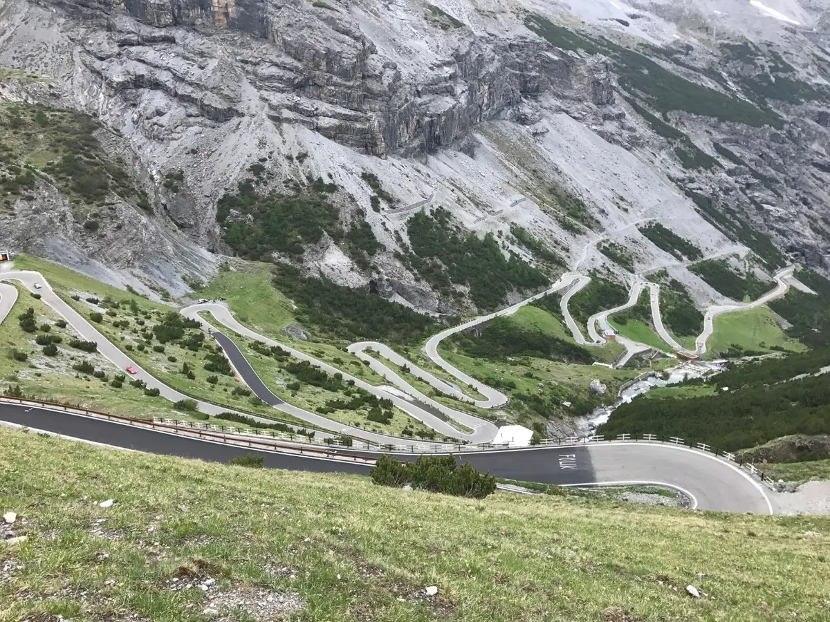
The roof of the route. Forty-eight hairpins on the Trafoi side, and the numbers count you down.

Late September on the Stelvio. Cold hands, empty hairpins, and the light doing all the work.
Down the hairpins to Trafoi, out into the Vinschgau through Prato and Glorenza — and if you have any time in hand, the walled medieval centre of Glurns is two minutes off the line and one of the best small towns in South Tyrol. Then up past Mals to the Reschensee at km 415, where the bell tower of the drowned village of Graun stands alone in the water. The lake flooded the village in 1950. The tower stayed.
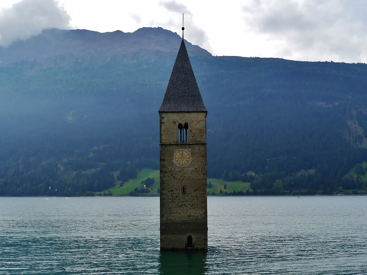
Graun's bell tower in the Reschensee. The rest of the village is under there.Photo: Zairon · CC BY-SA 4.0

Over the Reschen Pass at 1,504 m, km 422, past Nauders and the Norbertshöhe into Austria, then the long descent of the upper Inn through Pfunds, Landeck and Imst. The route sensibly avoids the motorway and takes the terrace roads above the valley — Fliess, Karres, Rietz, Hochzirl — before dropping into Innsbruck at km 545. It is not the most exciting hour of the trip, but you have just ridden the Umbrail and the Stelvio in the same morning and you will not mind.
Day three — Gerlos, the Grossglockner and the Puster valley, km 545–860
The longest transfer of the tour, bracketed by two of Austria's finest roads.
Out of Innsbruck down the Inn through Hall, Schwaz and Strass, then south into the Zillertal — Uderns, Zell am Ziller, and the climb onto the Gerlos Alpenstrasse. This is a toll road, 1,531 m at the pass, and the money buys you a long, wide balcony traverse above the Krimml waterfalls, the highest in Austria at 385 metres over three tiers. The viewpoint at km 631 is the stop.
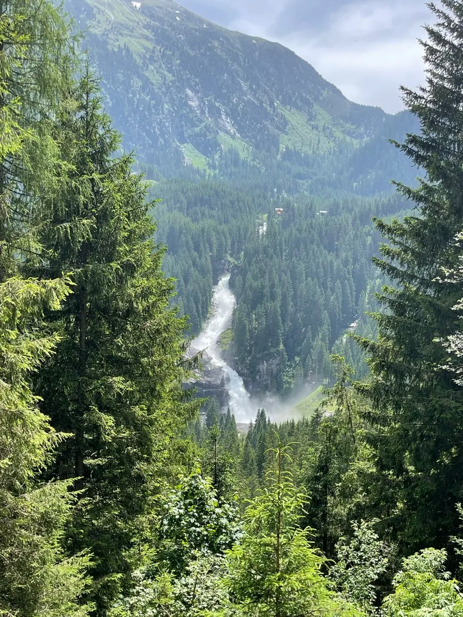
The Krimml falls from the Gerlos road, km 631. Free on the SommerCard, and worth the hour and a quarter up the Wasserfallweg.
If you are running the SommerCard version of this stage — and you should — this is where the day changes shape. Come over the Gerlos on the arrival voucher in the afternoon, park at P4 or P5 below Krimml, and walk up the Wasserfallweg on the card's free daily attraction. It is about an hour and a quarter to the top tier and you will be wet by the second one. Then it is twenty minutes down the valley to your bed, and the Glockner is a fresh day and a fresh mobility allowance in the morning.
Down through Krimml into the Pinzgau, east along the Salzach through Neukirchen am Großvenediger, Mittersill and Uttendorf to Bruck, and then the turn south to Fusch and the tollgate at Ferleiten, km 705.
Worth knowing: Neukirchen is Newchurch in the trade, home to the biggest brand-open motorcycle festival in the Austrian Alps — once Triumph's Tridays, now The Newchurch Summit, running 13–20 June 2027 (1000PS). It sits at the midpoint of this route, which makes it a reason to ride the traverse in June. Book early and see the practical notes.
The Grossglockner Hochalpenstrasse is the set piece of day three: 48 kilometres of purpose-built alpine road opened in 1935, thirty-six hairpins, and a summit tunnel at the Hochtor at 2,504 m, km 726. On the way up, take the spur to the Edelweissspitze at 2,571 m — the highest point of the whole road and the best 360-degree view in Austria — and stop at the Fuscher Törl. Then out through the Hochtor and down to Heiligenblut, where the Gothic spire of St Vincent's stands with the Grossglockner itself, 3,798 m, directly behind it.
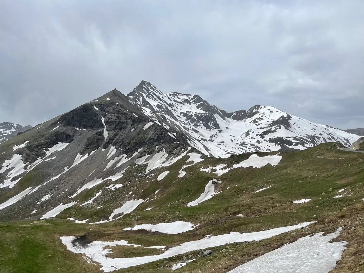
The Grossglockner does not always give you the postcard. This is the more likely version, and it is better for it.
Two things about this road. It is a toll road, and it is gated at night. Ride it as early in the day as the gates allow — from June the first gate lifts at half past five, and the hour before the coaches arrive is the reason to set an alarm.
Which is the argument for the split. A night in the Pinzgau puts you at Ferleiten at gate opening, and it makes both Austrian tolls free: the SommerCard's road entitlements are granted in addition to the one free attraction a day, so the Krimml walk the previous afternoon and the Glockner this morning do not compete for the same slot (SommerCard FAQs). Gerlos, waterfalls, bed, Glockner at first light, €46 of tolls unpaid. Full detail in the tolls section below.
From Heiligenblut the route runs down the Möll valley to Lienz at km 780, then west up the Puster valley through Sillian and across into Italy at San Candido and Dobbiaco around km 820. Turn south at Dobbiaco and the Dolomites open up: the Landro valley, the Tre Cime massif on your left, the Cristallo wall on your right, and the run down into Cortina d'Ampezzo at km 860.
Day four — the Dolomites, the Gavia and the Bernina, km 860–1,234
Three hundred and seventy-four kilometres with 6,821 metres of climbing. Be on the bike by seven.
Straight out of Cortina and up the Passo Giau, 2,236 m at km 872. Twenty-nine hairpins from the Cortina side, open meadow at the summit, and the rock towers of the Nuvolau and the Ra Gusela hanging directly above the pass sign. It is the finest pass road in the Dolomites and it is unusually quiet because everyone else is on the Falzarego.
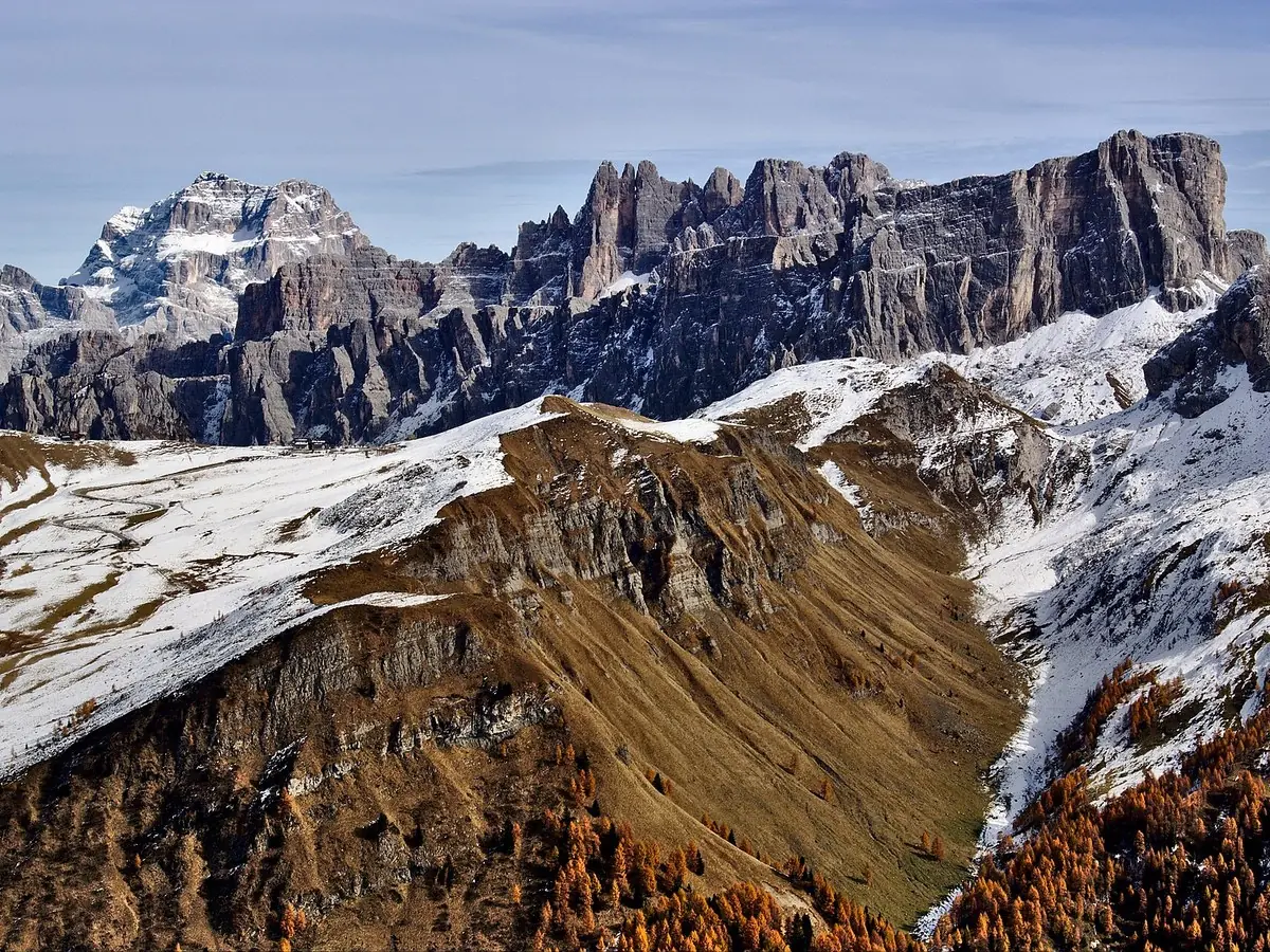
The view from Passo Giau. The finest pass in the Dolomites and the argument ends here.Photo: Marco Bonomo · CC0

Down the far side through Selva di Cadore to Caprile at km 887, with the north face of the Civetta filling the sky and the lake at Alleghe below. North through Digonera and up to Arabba, then the Sella Ronda proper: Passo Campolongo, 1,875 m at km 907, into Alta Badia; Corvara and Colfosco; Passo Gardena — Grödner Joch — 2,121 m at km 928, right under the wall of the Sella massif; and Passo Sella, 2,244 m at km 936, wedged between the Sella towers and the Sassolungo with the whole Val di Fassa laid out below and the Marmolada glacier closing the view.
Down through Canazei and Moena at km 969 — fuel here — then the Val di Fiemme, Predazzo, and the long descent to the floor of the Adige valley at Egna and the route's low point of 201 m around km 1,030. It is the one dull hour of the four days, and it is also where you will find the cheapest fuel and the best coffee.
Then it starts again. West into the Val di Non past Cles, up the Val di Sole through Malé and Vermiglio, and over the Passo del Tonale, 1,883 m at km 1,102. Down to Ponte di Legno, and turn north for the Passo Gavia.
Gavia, 2,621 m at km 1,129, is the one that will get your attention. Single lane in places, unbarriered on the drop side, a small dark lake at the summit and a rifugio that has been there long enough to have seen everything. It is the second-highest point of the whole route and it feels much higher than the Stelvio because there is nothing up there but you.
Down through Santa Caterina Valfurva to Bormio at km 1,154. This is where you should stop, if you have a fifth day.
If not, keep going: Passo Foscagno, 2,291 m at km 1,166, then Passo d'Eira, 2,208 m, and down into Livigno — a duty-free enclave where the fuel is the cheapest you will find anywhere on the route. Fill up. Then the Forcola di Livigno, 2,315 m at km 1,203, over the border back into Switzerland and down into the Val Poschiavo, where you turn north for the last climb of the tour.
The Bernina Pass, 2,328 m at km 1,211, with the Lago Bianco milky-white on one side and the Piz Bernina and the Morteratsch glacier off to the west. Then Pontresina, the Upper Engadine, and St Moritz at km 1,234.
Four days, three countries, twenty-two passes. Go and have that beer.
Best time to ride, and which passes will stop you
This route only works in high summer. That is not a preference, it is arithmetic: eleven of the twenty-two passes are above 2,200 metres and most of them are shut for seven months of the year.
The window is mid-June to mid-September. Before mid-June you are gambling on the late openers; after mid-September you are gambling on the early closers.
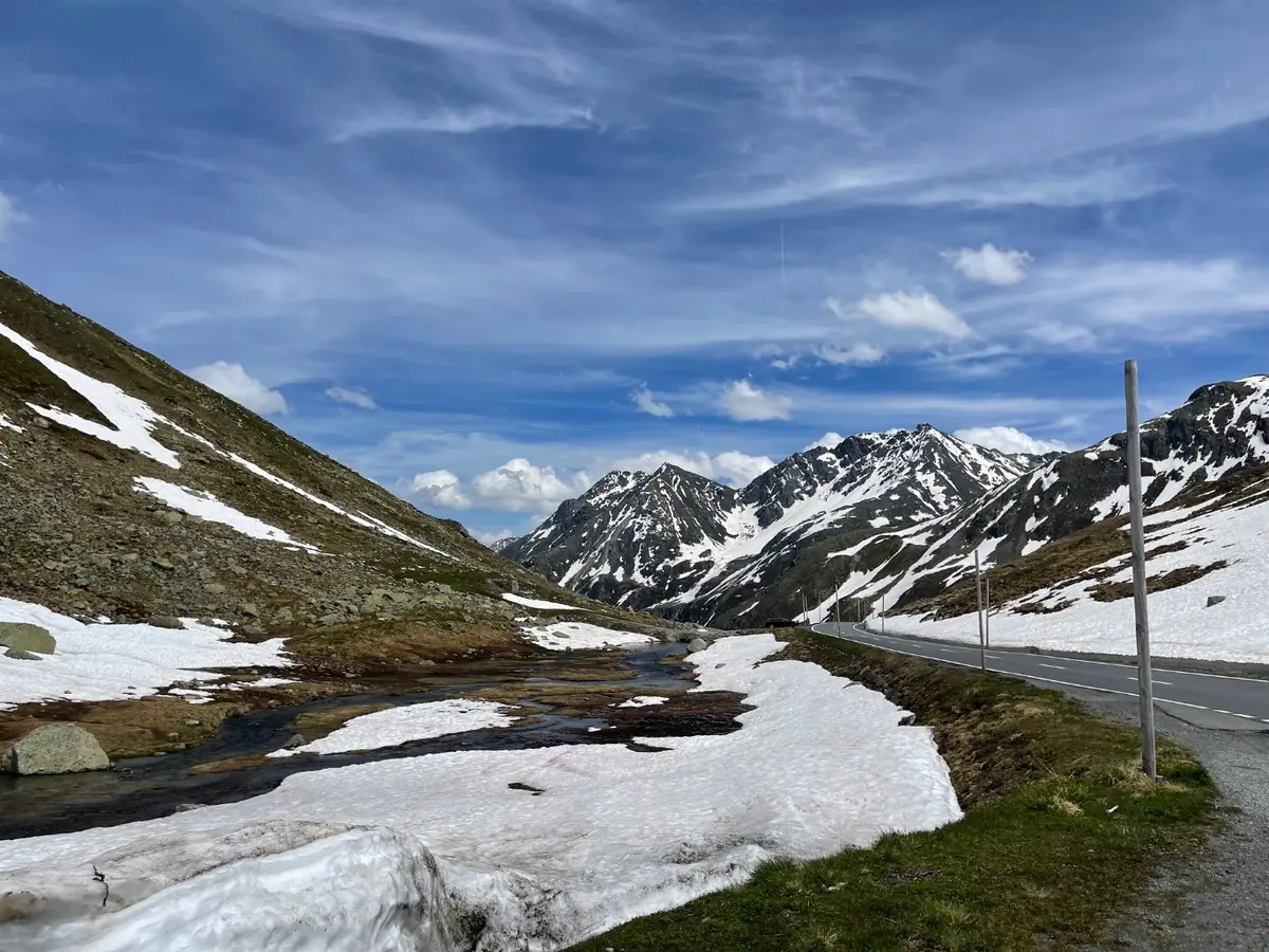
Open, but only just. This is what the high passes look like at the start of the season — dry tarmac, and a metre of old snow either side of it.
The passes that decide your dates. The Furka, Grimsel and Susten are consistently the latest-opening and earliest-closing trio in the Swiss network, typically late May into June and closing mid-October, and the historical opening tables going back to 1992 are published at alpen-paesse.ch. The Umbrail is normally the last pass in Graubünden to open each spring, at 2,501 m, and the canton publishes an annual notice when the pass roads "wake from winter hibernation" (Kanton Graubünden). The Stelvio and the Gavia both open late May to early June and close around mid-November, and both are described as provisional and weather-dependent by the regional authority — meaning summer snow can shut them at a few hours' notice (Valtellina.it). The Grossglockner is a fully seasonal road: the 2026 season opened on 25 April and runs to the start of November (grossglockner.at).
The passes that will not stop you. The Ofen Pass, Bernina, Maloja and Reschen are all open year-round, and the Gerlos Alpenstrasse runs 365 days a year (alpen-paesse.ch, gerlosstrasse.at). Keep that in your back pocket: if the Stelvio shuts on day two, the Ofen Pass and the Vinschgau will still get you to Tirol.
July and August are the busiest. Peak holiday season in all three countries means tour buses on the Stelvio, cyclists on the Sella Ronda and queues at the Grossglockner tollbooth. Mid-June and September give you almost every pass open with a fraction of the traffic, and that is when I would ride it.
Watch for event closures. The Stelvio is closed to motor traffic for cycling events several times a season. For 2026 the published dates include Sunday 12 July, 08:00–14:00 on the Bormio side, Saturday 29 August, 08:00–16:00 for the Scalata Cima Coppi — which closes all three approaches, Bormio, Trafoi and Santa Maria Val Müstair — and Saturday 19 September, 09:00–13:00 from Bormio (Valtellina.it, alpen-paesse.ch). The Sella Ronda passes — Campolongo, Gardena, Sella and Pordoi — are closed to all motor vehicles for Sellaronda Bike Day, with dates published each summer by the local tourist boards (Val Gardena, Alta Badia). Check these before you book anything.
Where to check on the day. alpen-paesse.ch and the TCS 77-pass live portal for Switzerland; STOL.it and the Land Tirol webcams for Tirol and South Tyrol; grossglockner.at for the Glockner; and Swissotic, which merges the Swiss, Austrian and Italian feeds into one table.
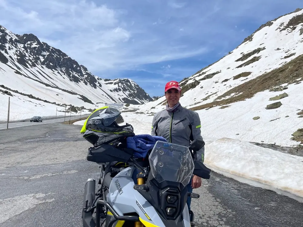
Layers on, and the reason for them is behind us. Early June at altitude is not summer.
Tolls, vignettes and what it costs to get through the gates
Most of this route is free. Four things are not.
Grossglockner Hochalpenstrasse. The big one. For 2026 the motorcycle day ticket is €36.50, or €32.50 for a fully electric bike, dropping to €30.00 if you enter after 18:00. A day ticket lets you use the road several times on the same day. If you want to come back tomorrow the second-day supplement is €17.50, and a three-week ticket — 22 consecutive days — is €73.00. There is also a Tour ticket at €55.50 covering the Grossglockner, Gerlos and Nockalm roads, which is €51.50 if you buy it in advance from ÖAMTC, ARBÖ or ADAC (grossglockner.at). For this route, where you ride the Gerlos and the Glockner on the same day, the advance Tour ticket at €51.50 costs you about six euros more than buying the two separately — only worth it if you are adding the Nockalmstrasse.
Grossglockner gate hours — read this bit. The road is locked at night and there is an official night-driving ban. For 2026 the gates run 06:00 to 20:00 in May, 05:30 to 21:00 from June through August, and 06:00 to 19:30 in September and October, with last entry 45 minutes before closing (grossglockner.at). On day three you want to be at the Ferleiten booth as it opens. An empty Grossglockner at half past five in the morning is one of the great motorcycling experiences in Europe. The same road at eleven o'clock in August is a car park with a view.
Gerlos Alpenstrasse. Cheap and worth it: €9.50 motorcycle day ticket, €8.50 electric, €21.50 for eight days. Open 365 days a year (gerlosstrasse.at).
The Nationalpark SommerCard — how to ride both Austrian toll roads for nothing. This is the single best piece of value on the whole traverse and most riders passing through have never heard of it.
If you spend a night in a participating hotel, guesthouse, private room, apartment or farm in the Nationalpark Hohe Tauern holiday region — that is the Pinzgau corridor the route already runs straight through: Krimml, Königsleiten, Neukirchen, Bramberg, Mittersill, Uttendorf, Kaprun, Zell am See, Bruck, Fusch and Rauris — your host gives you the Nationalpark SommerCard free of charge on arrival. You cannot buy it; it comes with the bed. It runs 1 May to 31 October and covers the whole stay, arrival and departure days included (Nationalpark SommerCard FAQs, krimml.com).
What it gives you that matters here:
- A day ticket for the Grossglockner Hochalpenstrasse, valid for one car or motorbike — the official regional page specifies one day ticket per stay (nationalpark.at). That is €36.50 back in your pocket.
- A day ticket for the Gerlos Alpenstrasse. Another €9.50.
- Crucially, these mobility benefits sit on top of the card's one-free-attraction-per-day allowance, so using the Glockner ticket does not burn your daily entry (SommerCard FAQs).
- One free attraction per day from more than sixty, and roughly 50% off further ones once the daily entry is used. Krimml Waterfalls and the Worlds of Water are on the list, with free parking at P4 and P5 (nationalpark.at).
- Free public transport across the whole of SalzburgerLand for the duration of the stay under the Guest Mobility Ticket — not much use on a bike, but worth knowing if the weather turns and you leave it in the hotel car park for a day.
The trick is the arrival voucher. Ask your accommodation to send the card digitally, or send the arrival voucher, before you set off. It can then be used on the way in — so you ride up over the Gerlos on the voucher, sleep somewhere in the Pinzgau, and ride the Grossglockner on the card at gate opening the next morning (krimml.com). Both Austrian tolls, €46 of them, for nothing.
One honest caveat: the official wording on the Glockner ticket is "per stay" rather than per day, and the various regional pages are not perfectly consistent about the Gerlos. Confirm with your host when you book — they issue the card and they will know.
Swiss vignette. CHF 40 for a motorcycle, as a sticker or as an e-vignette bought online, valid from 1 December of the previous year to 31 January of the next (Swiss Federal Office for Customs and Border Security). Strictly speaking the pass roads themselves are ordinary cantonal roads and need no vignette, but the route uses motorway sections around Chur and the Rhine gorge on day one, and you will almost certainly use Swiss motorway to get to Airolo in the first place. Buy one.
Austrian vignette. Motorcycles are a reduced category: €5.10 for ten days, €12.80 for two months, €3.80 for a single day, €42.70 annual, prices as of 1 December 2025 (ASFINAG). The route mostly uses B-roads through Tirol rather than the A12, but the ten-day vignette costs less than a round of coffees and removes the question entirely. Note that digital two-month and annual vignettes are only valid from the 18th day after online purchase — buy the 10-day or 1-day if you are leaving soon.
Italy. No vignette. The autostrada network is distance-based pay-as-you-go, and this route does not use it. Every Italian pass on the traverse — Stelvio, Giau, Gardena, Sella, Tonale, Gavia, Foscagno — is a free provincial road.
Livigno. A duty-free enclave, so fuel is significantly cheaper than in Italy, Switzerland or Austria, with published allowance limits on what you can take out (livigno.eu). Arrive on fumes on day four and fill to the brim.
What's in the GPX
The file is a GPX 1.1 track built in Scenic, with twenty named waypoints embedded. Load it into Scenic, Kurviger, Garmin, TomTom, Calimoto or OsmAnd and the stops below will appear on the map with a short note attached to each.
| # | Waypoint | Why stop |
|---|---|---|
| 1 | Airolo — foot of the Tremola | Start — fill up here, the cobbles begin immediately — km 0 |
| 2 | Furka Pass — 2,429 m | Bond country, and the highest point of day one — km 40 |
| 3 | Gletsch — Rhone Glacier | Hairpin junction below the glacier and the ice grotto — km 51 |
| 4 | Gadmen — Susten west ramp | Coffee at the bottom of the best-built pass in Switzerland — km 96 |
| 5 | Oberalp Pass — 2,044 m | The gateway out of Uri and into Graubünden — km 149 |
| 6 | Flüela Pass — 2,383 m | Bleak, high and beautiful — the way out of Davos — km 295 |
| 7 | Ofen Pass — Pass dal Fuorn | 2,149 m through the Swiss National Park — open all year — km 336 |
| 8 | Umbrail Pass — 2,501 m | Switzerland's highest pass road, and the quiet way onto the Stelvio — km 363 |
| 9 | Stelvio Pass — 2,757 m | The roof of the route — 48 hairpins on the Trafoi side — km 366 |
| 10 | Reschensee — Graun bell tower | The drowned village and its church tower in the water — km 415 |
| 11 | Gerlos Pass — Hochkrimml | Toll road, 1,531 m, and the Krimml waterfall viewpoint — km 631 |
| 12 | Ferleiten — Grossglockner tollgate | North gate of the Grossglockner High Alpine Road — km 705 |
| 13 | Passo Giau — 2,236 m | The best pass in the Dolomites. No argument — km 869 |
| 14 | Caprile — Lago di Alleghe | Green lake under the Civetta north face — km 887 |
| 15 | Digonera — Rocca Pietore | Junction under the Marmolada, gateway to Arabba — km 893 |
| 16 | Colfosco — below Passo Gardena | Alta Badia, on the ramp to the Grödner Joch — km 926 |
| 17 | Passo Sella — 2,244 m | Sella towers on one side, Sassolungo on the other — km 936 |
| 18 | Moena — Val di Fassa | Last Ladin town before the long drop to the Adige — km 969 |
| 19 | Bormio — Alta Valtellina | Thermal baths, medieval centre, and the crossroads of the high passes — km 1,154 |
| 20 | St Moritz — Engadine | Finish — 1,822 m, lake, and a very expensive beer |
Practical notes
Fuel. Plan on three fills a day, not two. The dangerous stretches are the Grimsel–Susten loop on day one, where there is nothing between Gletsch and Innertkirchen; the Ofen–Umbrail–Stelvio sequence on day two, where you should leave Zernez full; and the Grossglockner on day three, where the last pump before the tollgate is in Fusch. Fill in Livigno on day four because it is duty-free and cheap. Bear in mind that Sunday closures still catch people out in rural Austria and Switzerland.
Get the Grossglockner and the Gerlos for free. Stay one night at a participating hotel, guesthouse, apartment, private room or farm inside the Nationalpark Hohe Tauern holiday region — Krimml, Königsleiten, Neukirchen, Bramberg, Mittersill, Uttendorf, Kaprun, Zell am See, Bruck, Fusch or Rauris — and your host hands you the Nationalpark SommerCard free with the room. It includes a day ticket for the Grossglockner Hochalpenstrasse (one per stay, car or motorbike) and a day ticket for the Gerlos Alpenstrasse, which is €46 of tolls covered, plus one free attraction a day from sixty-odd including the Krimml Waterfalls. Valid 1 May to 31 October. Ask for the digital card or the arrival voucher before you leave home so you can use it on the way in over the Gerlos, then ride the Glockner free at gate opening the next morning (Nationalpark SommerCard, nationalpark.at). Confirm the exact terms with your host when you book. Full detail in the tolls section above.
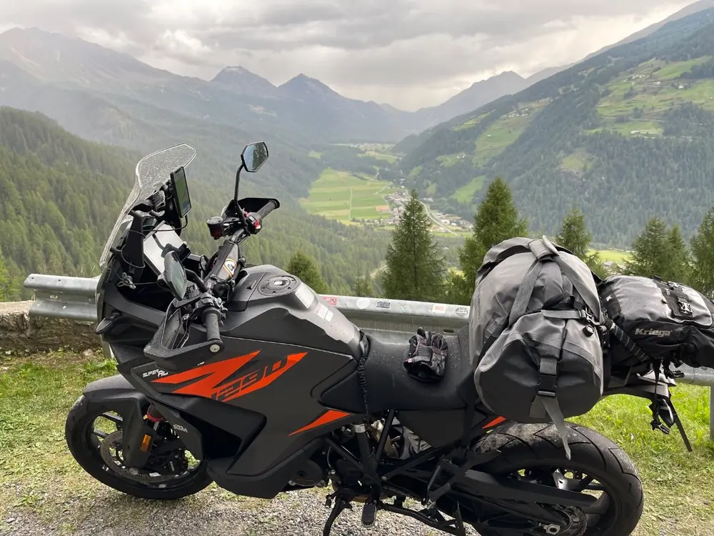
Pack light and pack soft. Four days, three countries, and one bag you can carry up a hotel stair.
Cold. It can be twenty-eight degrees in Bormio and four degrees on the Gavia summit forty minutes later. Eleven of these passes are above 2,200 m. Carry a windproof mid-layer and waterproofs even on a perfect forecast, and check the summit webcams rather than the valley forecast.
Altitude and the bike. Above 2,500 m — Stelvio, Umbrail, Gavia, Hochtor, Forcola — you will feel the power drop off. Not a problem, just do not plan an overtake on the assumption of sea-level performance.
Surfaces. Almost all excellent. The exceptions are the Tremola cobbles at km 0, gravel washed onto hairpin apexes on the Umbrail and the Gavia after rain, and cow muck on the Alta Badia and Zillertal side roads in the morning. The Gavia summit section is single-lane with no barrier — if a van is coming down, you are the one who reverses.
Cyclists. All day, every day, on every pass. On the Stelvio, the Gavia, the Giau and the Sella Ronda group in particular there will be hundreds of them, often three abreast on a blind hairpin. Give them room and expect nothing.
Tunnels. Sunglasses off before you go in, especially on the Landro road and the descents into Innertkirchen and Poschiavo.
Documents. Three countries, three sets of rules. Carry licence, registration and insurance. Austrian and Swiss speed enforcement on descents is thorough and unsentimental.
The Newchurch Summit. The festival at Neukirchen am Großvenediger, km 645, runs 13–20 June 2027, weekend 17–20 June (1000PS). Tickets were €16 a day or €26 for the weekend in 2026. Two things if you build the tour around it: mid-June is early, so the Furka, Grimsel, Stelvio and Gavia may not all be open — and the whole valley books out months ahead.
Where to break day three. As written, day three runs Innsbruck to Cortina in one 315 km push and you pay both Austrian tolls in cash. Splitting it in the Pinzgau is the better plan on almost every count. Neukirchen at km 645, Mittersill at km 660, Bruck an der Grossglocknerstrasse at km 690 and Fusch at km 700 are all within a few minutes of the line, all inside the SommerCard region, and all within striking distance of the Ferleiten tollgate for a first-light start. It turns the traverse into five days, saves the €46, and means you hit the Glockner at half past five with the road to yourself instead of at midday behind a coach.
If you want to stretch it. There are two natural extra nights and they are both worth having. The first is the Pinzgau stop above, which pays for itself. The second is Bormio at km 1,154: ride Cortina to Bormio as a stage of 295 km and +5,217 m — the Dolomite passes, the Tonale and the Gavia — then Bormio to St Moritz as a short, glorious final morning of 79 km and +1,602 m over Foscagno, Eira, Livigno, Forcola and the Bernina. You get a night in a spa town with the thermal baths at Bagni Vecchi, and you finish on the Bernina at ten in the morning with the light doing exactly what you want it to. Take both and the traverse becomes a comfortable six days with no stage over 300 km.
If you have to cut something. Do not cut day two. The Flüela–Ofen–Umbrail–Stelvio sequence is the best ninety kilometres of the entire traverse, and the Umbrail approach to the Stelvio is the single best-kept secret on the route.