A Round of the Heuvelland
128 km out of Valkenburg through the Dutch and Belgian Limburg hills — steep little valleys, orchards, wooded ridges and marl villages, with the German border thrown in for good measure.
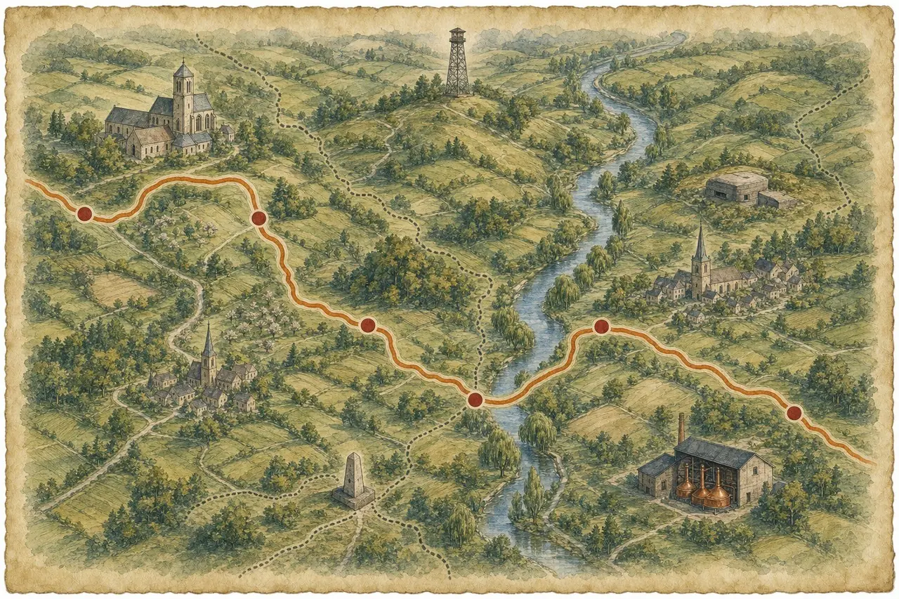
Three countries, half a day, one long corner
Valkenburg out through the Geul valley to Gulpen, up over Vijlen to Vaals and the Drielandenpunt, across into the Pays de Herve for Battice and Val-Dieu, then home the back way through the Voer region and Noorbeek. It criss-crosses the border so naturally that the ride feels less like two countries and more like one long, undulating corner of Europe.
Moving time only — it excludes stops. Fuel, coffee breaks and lunch easily add a couple of hours to the day, so plan accordingly.

"Border crossings without ceremony, village breweries, abbey valleys and ridge-top views. Classic Heuvelland at its most beautiful."
— Alan Jones, on A Round of the HeuvellandElevation profile
How it rides
This is not a long ride and it is not a difficult one. What it is, is relentlessly interesting: a landscape of steep little valleys, orchards, wooded ridges and constantly changing views, packed into a corner of Europe small enough to cross three borders before lunch.
Leaving Valkenburg, the route follows the lovely Geul valley towards Wijlre and Gulpen. Everything is narrow, everything turns, and the hedgerows are high enough that the view keeps opening and closing on you. There is more climbing here than the map suggests — about 1,570 metres of it over 128 km, which is why the Heuvelland feels nothing like the rest of the Netherlands.
Stop 1 — Gulpen: the Gulpener brewery
In Gulpen, the Gulpener Brewery makes a fitting early stop — an iconic local brewery surrounded by the very hills and fields that shape its beers. It is about a kilometre off the line, so treat it as a deliberate detour rather than something you will roll past.
Stop 2 — Vaals: the Wilhelminatoren and the Drielandenpunt
The route then rises through Eys and Wahlwiller towards Vijlen and Vaals, where the scenery becomes more elevated and more wooded. This is the high point of the ride in both senses: 334 metres, and the best of the tree-lined ridge roads.
Near Vaals, pause at the Drielandenpunt — the Three-Country Point where the Netherlands, Belgium and Germany meet. It is a classic photo opportunity, with forest trails, the border markers and the nearby Wilhelminatoren tower adding a sense of height to the landscape. Both sit within a few dozen metres of the track, so neither costs you anything to visit.
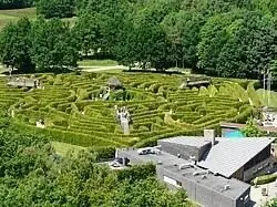
The hedge labyrinth at the Drielandenpunt, seen from above.
Stop 3 — Battice: the fort
Crossing into Belgium near Gemmenich, the ride heads through the quiet Pays de Herve. Around Battice, look out for Fort de Battice, a substantial Belgian defensive fort built before the Second World War and fought over during the German invasion in 1940. The route passes within about 300 metres of it, so even a brief detour or exterior look gives the ride a striking historical dimension.
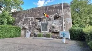
Fort de Battice — the entrance block and memorial.
Stop 4 — Val-Dieu: the abbey
Further south, Val-Dieu is an especially good rest stop. The abbey sits in a peaceful green valley near Aubel, with its historic buildings, café and brewery atmosphere providing a calm contrast to the rolling roads. It is one of those places where the landscape invites you to slow down.
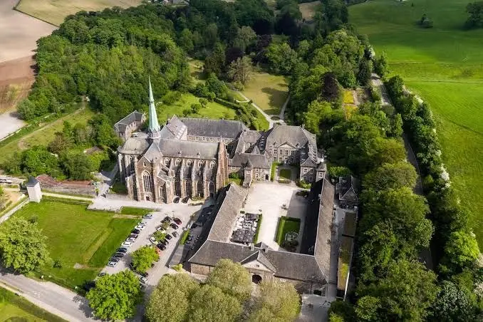
Abbaye du Val-Dieu, tucked into its green valley near Aubel.
If you are only going to stop once on this route, stop here.
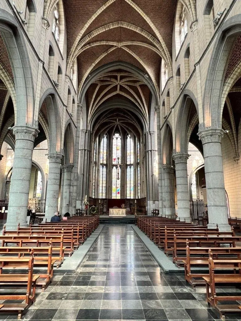
Worth stepping inside: the nave of the abbey church.
Stop 5 — Mescherheide: the lookout tower
The return leg heads west through the patchwork countryside of the Voer region — small villages, hollow lanes and open pastureland — before crossing back into the Netherlands. Near Mesch, the Mescherheide lookout tower is well worth a pause: it offers expansive views over the Maas valley and the surrounding Dutch-Belgian border country, particularly rewarding in clear evening light.
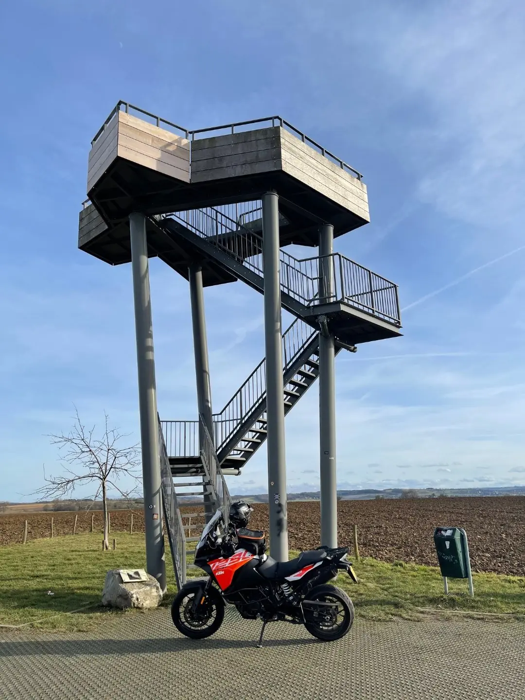
The Mescherheide lookout tower — climb it for the Maas valley view.
Home through Noorbeek and the Geul
From there, the route turns back through Noorbeek, Gulpen and the Geul country toward Valkenburg. It is a ride built around small discoveries: border crossings without ceremony, historic landmarks, village breweries, abbey valleys and ridge-top views — classic Heuvelland at its most beautiful.
What's in the GPX
The file is a GPX 1.1 track built in Kurviger, with eight named waypoints already embedded. Load it into Kurviger, Garmin, TomTom, Calimoto, OsmAnd or Scenic and the stops below will appear on the map with a short note attached to each.
| # | Waypoint | Why stop |
|---|---|---|
| 1 | Valkenburg aan de Geul | Start and finish, in the heart of the Geul valley |
| 2 | Gulpener Brouwerij, Gulpen | Iconic Limburg brewery — about 1 km off the route |
| 3 | Wilhelminatoren, Vaals | Lookout tower on the Vaalserberg ridge |
| 4 | Drielandenpunt, Vaals | Where the Netherlands, Belgium and Germany meet |
| 5 | Fort de Battice | Pre-war Belgian fort, besieged in May 1940 |
| 6 | Abbaye du Val-Dieu, Aubel | Abbey, café and brewery in a quiet green valley |
| 7 | Uitkijktoren Mescherheide, Mesch | Wide views over the Maas valley |
| 8 | Noorbeek | Hollow lanes and pastureland on the run home |
Practical notes
If you need fuel, fill up in Belgium — petrol is generally considerably cheaper than in the Netherlands. The route is not especially long or difficult, but in July and August this is a popular tourist area, with plenty of cyclists and hikers on the lanes and paths, so allow extra time and ride patiently.
My favourite time is early evening, when traffic drops to almost nothing. It is the perfect excuse to wander a little, find a quiet viewpoint or village edge, and watch the sun sink low as the hills and fields turn amber in the evening light.