Ultimate Wales Part One
Into the Valleys. 560 km over two days from Newport to the foot of the Llanberis Pass — miners' mountain roads, the Black Mountain Pass, the Abergwesyn drovers' road, the Elan dams and the Dylife mountain road, with some optional gravel for those who want it.
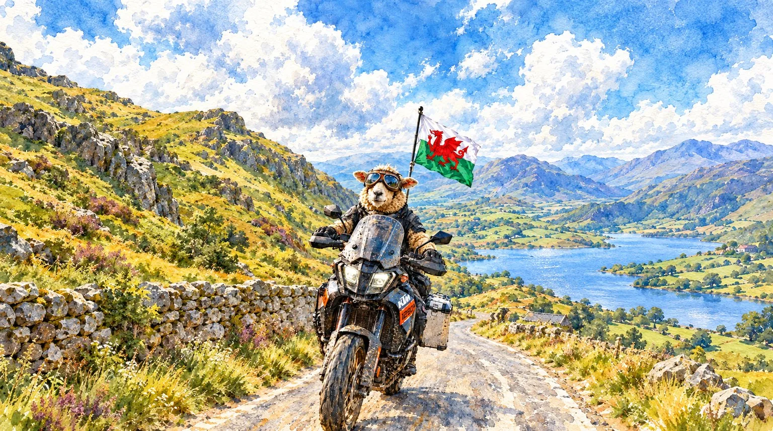
Into the Valleys — two days, 560 km, from the Valleys to the foot of Yr Wyddfa
Head west early and leave the motorway behind at Miskin, and within the hour you are climbing the Bwlch above the Ogmore valley. That is how day one starts and it barely lets up: the Rhondda, the Rhigos, the Black Mountain Pass, the Devil's Staircase and the Elan Valley dams before you park up in Rhayader as the sun sets. Day two heads north over the Dylife mountain road, along Llyn Tegid and across the Denbigh Moors, then up into Eryri and over the Llanberis Pass. This is part one. If you know these roads better than I do, tell me — your tips could turn this into a longer trip.

Android and the file opens as text? Download the ZIP version instead, open it in your Files app to extract the GPX, then import it into Kurviger, Garmin, TomTom, Calimoto or your usual app.
"The Valleys roads were built by out-of-work miners in the 1920s. A hundred years on, they are still some of the best bends in Britain."
— Alan Jones, on Ultimate Wales Part OneElevation profile
How it rides
Five hundred and sixty kilometres over two days, with about 7,600 metres of climbing. Day one is the big one: 293 km and seven and a half hours of moving time, almost all of it on mountain roads, valley roads and single track. Day two is 267 km and five hours of riding on faster, flowing A and B roads, finishing with the best scenery of the trip.
Start early on both days. Add coffee, lunch, fuel and photo stops and day one is a ten-hour day door to door. Day two is closer to seven.
Ride it between April and October. Most of these roads go above 400 metres, and in winter the Abergwesyn Pass is often closed by snow. I am planning to ride it myself next season.
Day one — up the Bwlch, km 0–62
Fill up in Newport and head west. You join the M4 at High Cross, junction 27, and the first 27 km are motorway, there simply to get you past Cardiff quickly. You leave it at Miskin, junction 34, and from there it is the A4119 and A473 through Talbot Green and Llanharan, then lanes through Brynna and Heol-y-cyw to Bryncethin, Blackmill and up the Ogmore valley to Nant-y-moel.
Then the first proper climb of the trip: the Bwlch. The A4061 over Bwlch-y-Clawdd opened at the end of 1928 as an unemployment relief scheme, built largely by out-of-work miners, and it tops out at 450 metres. Hairpins on the way up, the Rhondda Fawr laid out in front of you at the top, and on a clear day the Bristol Channel and Exmoor behind. There is usually a snack van at the viewpoint.
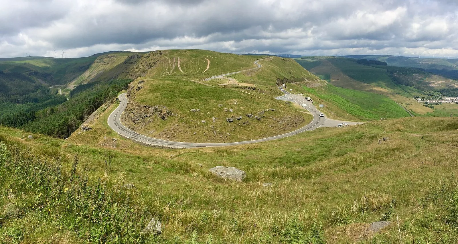
The Bwlch, looking down on the A4061 between the Ogmore and Rhondda valleys. Photo: Alan Hughes, CC BY-SA 2.0, via Geograph.
.jpg)
From the top the route heads west along the A4107, over open moorland at more than 500 metres.
Day one — optional gravel at Blaenrhondda, km 62–67
At km 62 the GPX leaves the tarmac for an unpaved spur north across the hill, about 2.7 km each way on gravel and rougher track. It takes you to the highest point of the trip, 538 metres, then back the same way to the A4107. On a road bike, stay on the tarmac and pick the line back up when it rejoins.
Day one — the Rhondda and the Rhigos, km 67–106
Back along the A4107 and down the Bwlch into Cwmparc and Treorchy, then up the valley to Treherbert and onto the Rhigos Road, the A4061's other mountain section, opened in November 1929.
Optional gravel, km 85–93. Partway up the Rhigos the GPX turns off onto a gravel loop of about nine kilometres, which brings you back down to Treherbert. Then you climb the Rhigos again on the tarmac. On a road bike, skip the loop and carry on up the Rhigos Road. You lose nothing, and the line comes back to you.
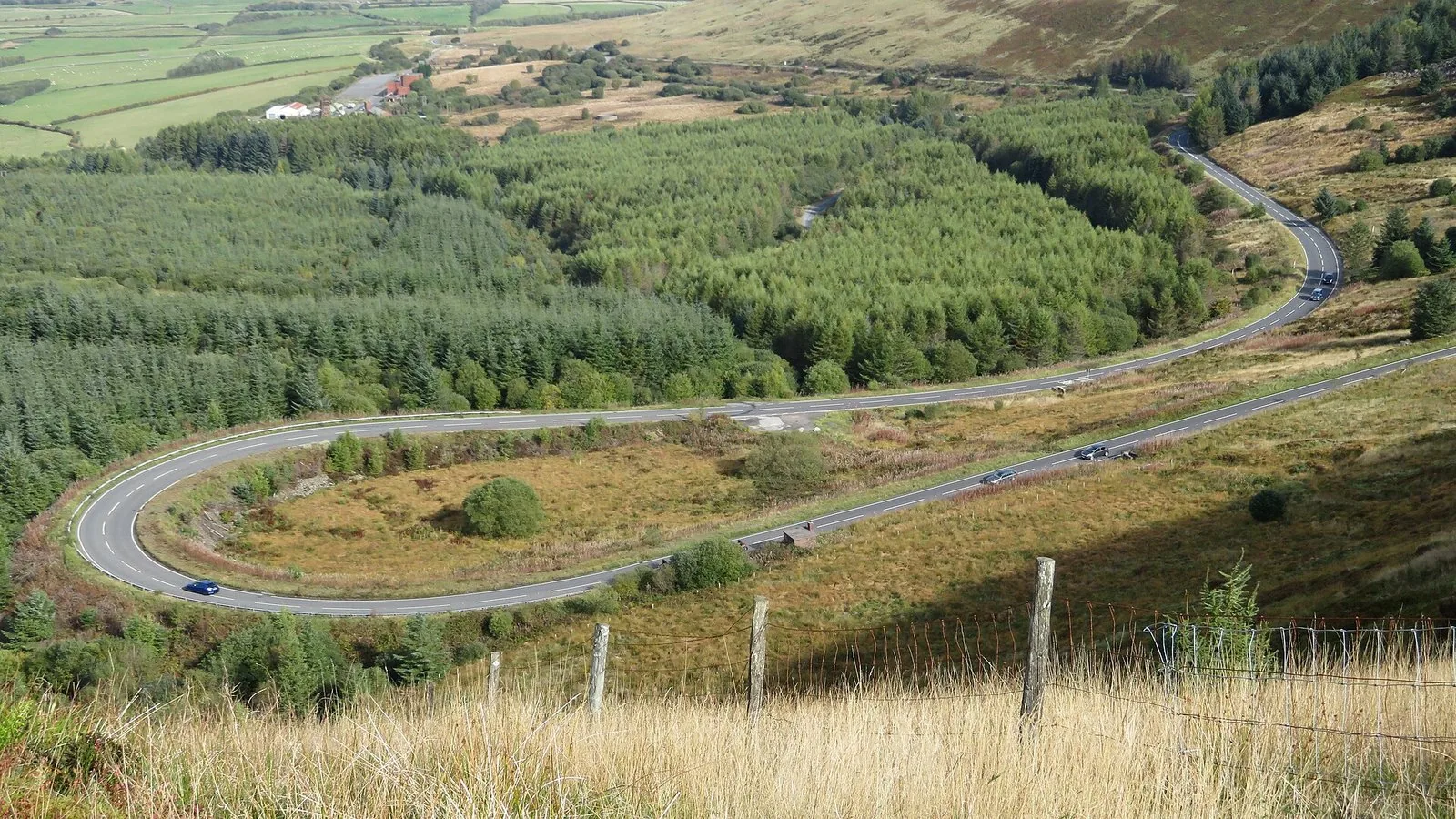
The hairpin on the Rhigos Mountain Road. Photo: Gareth James, CC BY-SA 2.0, via Geograph.

Over the top of the Rhigos the Vale of Neath and the Brecon Beacons open up in front of you, and Craig y Llyn, the highest point of the South Wales coalfield, is on your left. Then down to Hirwaun.
Day one — west to the Black Mountain, km 106–163
Head west on the Heads of the Valleys road towards Glynneath, then the A4109 through Banwen and Coelbren and the A4067 into Ystradgynlais. The route then climbs on narrow lanes over Rhiwfawr and Ystradowen into Brynamman, and that is where the next big road starts.
The Black Mountain Pass, the A4069 from Brynamman to Llangadog. This is the Top Gear road, and it deserves the reputation: a long climb onto the western edge of the Brecon Beacons, a summit at 493 metres and the famous Tro Gwcw, the Cuckoo Turn, on the way down. There is a 40 mph limit with average speed cameras, and the sheep do not care what you are riding. Head north off the mountain into Llangadog.
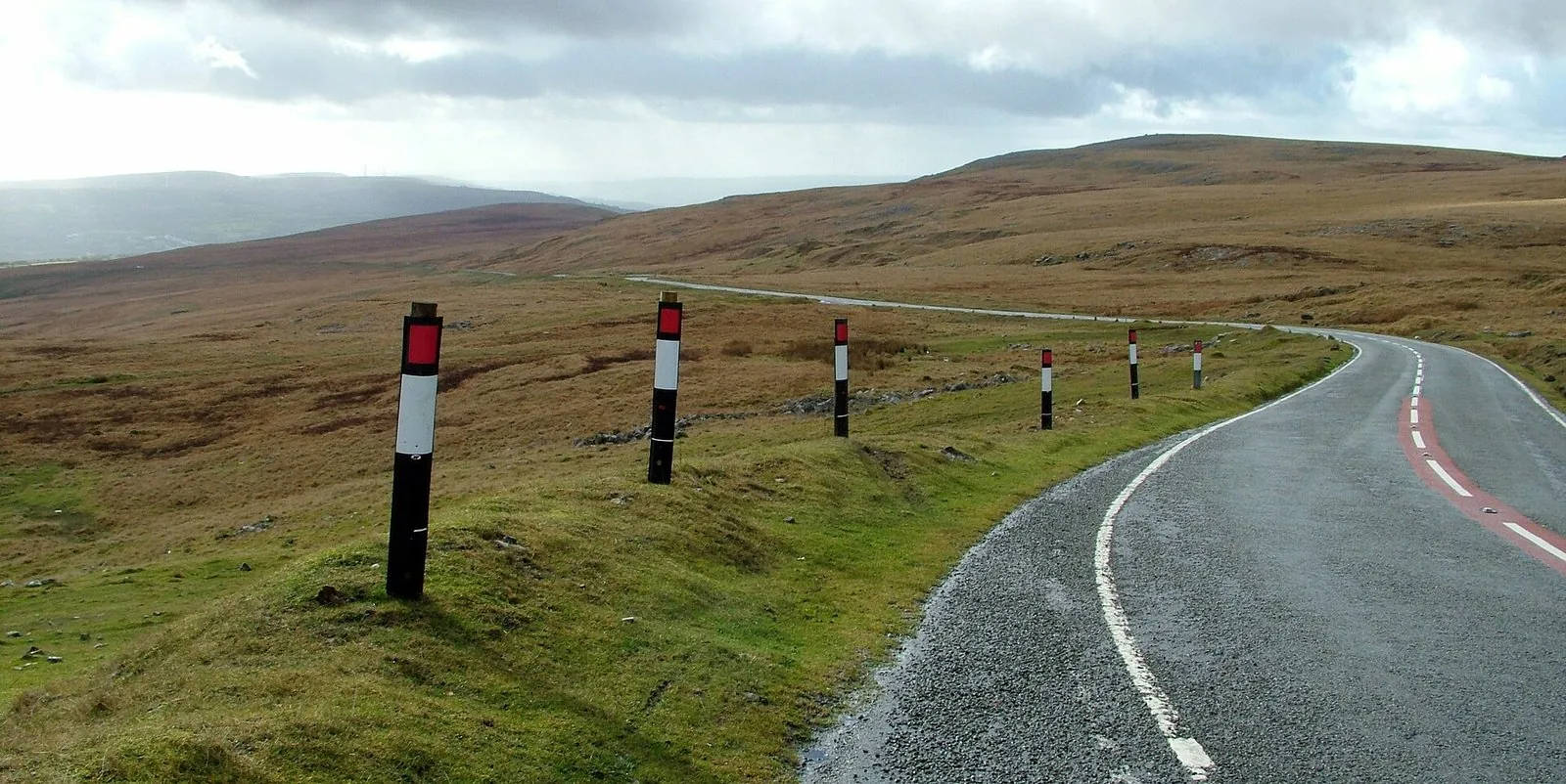
The A4069 over the Black Mountain. Photo: Peter Evans, CC BY-SA 2.0, via Geograph.

Day one — Llandovery and the Abergwesyn Pass, km 163–245
Llandovery at km 172 is your lunch stop. The route runs straight down Broad Street past the West End Café, a family-run place open seven days a week and a favourite with bikers. Fuel up here too.
North on the A483 to Llanwrtyd Wells, then the road everyone talks about: the Abergwesyn Pass, about 30 km of single track over the Cambrian Mountains towards Tregaron. It was a drovers' road, and in the middle is the Devil's Staircase, a steep series of hairpins up out of the Irfon valley. Gravel washes onto it, there are sheep everywhere and the drops are not fenced. Take it steady and give way to anything coming up.
The route takes you over the top towards Tregaron and then back the same way, so you get the Devil's Staircase in both directions. Before you turn back there is one more optional gravel spur.
The Tregaron spur, km 214–220, is about 2.8 km each way on an unsurfaced track and back the same way. On a road bike, turn round where the tarmac ends.
Back over the pass to Abergwesyn, then east through Beulah and Newbridge-on-Wye and up into Rhayader on the A470.
Day one — the Elan Valley and Rhayader, km 266–293
Before you stop for the night, one more loop: out of Rhayader on the B4518 to the Elan Valley. The dams were built from 1893 to supply Birmingham with water and opened by Edward VII in 1904. The route takes you past the Elan Valley Hotel to Caban Coch and Garreg Ddu, then back into Rhayader as the sun sets.
Day two — Clywedog and the Dylife mountain road, km 0–58
Head north out of Rhayader early on the B4518 through St Harmon to Llanidloes, then keep on the B4518 above Llyn Clywedog. The dam is 72 metres high, the tallest concrete dam in the UK, and sits about a kilometre off the line.
Then Staylittle and the Dylife mountain road, the high point of day two at 513 metres. The slate memorial to the broadcaster Wynford Vaughan-Thomas is near the top, and the view north to the mountains of Eryri is the one he made famous. The Star Inn at Dylife reopened in 2025 if you fancy an early stop. From the top it is a long, steep, twisting drop into Machynlleth. Fuel and coffee here.
Day two — north to Llyn Tegid, km 58–110
Over the Dyfi Bridge and north on the A487 through Corris to the A470, then the A494 towards Bala. At Llanuwchllyn the route takes the B4403 along the south-east shore of Llyn Tegid, Bala Lake, six kilometres long, with the narrow-gauge railway running alongside. Bala is a good mid-morning stop.
Day two — the Dee valley to Llangollen, km 110–175
Head east on the B4401 through Llandderfel and Cynwyd, quiet and fast with the Dee beside you, to Corwen. Then the A5 into Llangollen and over its old stone bridge, and north on the A542 past Valle Crucis Abbey, founded in 1201. The route climbs towards the Horseshoe Pass before turning back above Llandynan.
A word on the Ponderosa: the famous bikers' café at the top of the Horseshoe Pass closed in March 2025 after 42 years. In September 2026 it was still under offer, waiting for a sale to complete, so do not plan your lunch around it. The route does not go up that far anyway.
Back along the A5 to Corwen.
Day two — the Denbigh Moors, km 175–240
North-west on the B4501 through Cerrigydrudion and past Llyn Brenig, a reservoir at 370 metres with a lakeside café at the visitor centre. Then across the open, empty Denbigh Moors on the A543, topping out at about 464 metres, and down to the A5 at Pentrefoelas.
Day two — into Eryri and over the Llanberis Pass, km 240–267
West on the A5 into Betws-y-Coed, the bikers' meeting place of North Wales. On any decent weekend there will be bikes lined up near the main car park and the ice-cream shops. A loop north on the B5106 towards Llanrwst and back over the hill brings you onto the A5 again at Pont Cyfyng.
Then Capel Curig, where Caffi Siabod on the A5 is the last proper stop of the trip. Turn left onto the A4086 and up into the Llanberis Pass: over the top at Pen-y-Pass, 359 metres, with Yr Wyddfa on one side and the Glyderau on the other, then down a narrow, rocky, steep-sided valley with boulders the size of houses beside the road.
Part one ends at the bottom of the pass in Nant Peris. Llanberis is three kilometres further on, with beds and food.
Optional gravel — read this first
The GPX includes five short unpaved sections, about 22 km in all. They are optional. Every one is a spur or a loop off the tarmac, so you can skip any of them without losing the route.
Day one, km 62–67. Blaenrhondda spur off the A4107. Gravel, then rougher grassy track, up to the trip's high point and back.
Day one, km 85–93. Rhigos loop. Mostly well-graded gravel, back down to Treherbert.
Day one, km 214–220. Tregaron spur off the Abergwesyn Pass. Unsurfaced track, out and back.
Day two, km 34. A short track near Staylittle, under a kilometre out and back. This one is mapped as a public footpath, and motor vehicles are not allowed on public footpaths in Wales. Skip it and stay on the tarmac.
Day two, km 157. Gravel track above Llandynan, off the A542, under a kilometre each way.
Before you ride any of them, check that motor vehicles are allowed. In Wales, only some unsurfaced roads carry vehicle rights, and the status of a track can change. If there is a sign saying no motor vehicles, or a closed gate, turn round. These are for adventure bikes and trail bikes in the dry. After rain the grassy sections get slippery fast.
Where to stay
End of day one — Rhayader. Rhayader is a proper bikers' town. The Lion Royal Hotel on West Street has a long association with riders: a secure courtyard car park, a large covered garage, and they will dry your kit. The Elan Valley Hotel is right on the route at the mouth of the valley. Elan Valley Lodge suits groups and has secure bike storage. Penralley House is a B&B close to the centre.
For the evening, The Cornhill Inn on West Street is a sixteenth-century pub popular with bikers, with plenty of parking and a bike wash. The Triangle Inn does hearty pub food by a fire.
End of day two — Nant Peris and Llanberis. The Royal Victoria Hotel in Llanberis sits between Llyn Padarn and Llyn Peris, a classic base at the foot of Yr Wyddfa. Glyn Afon Guesthouse is a three-star B&B in the village. For food, Pete's Eats is a Llanberis institution, reopened in 2025 with a new menu, and the Lone Tree Café does big breakfasts and lunches.
If you would rather stop short of the pass, the Bryn Tyrch Inn at Capel Curig is a former coaching inn with mountain views.
Bikers' cafés on the way
The Bwlch, day one km 61 — snack van usually parked at the viewpoint.
West End Café, Llandovery, day one km 172 — right on the route, open seven days.
Llanwrtyd Wells, day one km 191 — the Neuadd Arms on the square, and TOST, which welcomes bikers.
Elan Valley Visitor Centre, day one km 276 — café below the Caban Coch dam, open daily.
The Star Inn, Dylife, day two km 41 — a seventeenth-century drovers' inn, reopened in 2025. Closed Monday and Tuesday.
Caffi Brenig, Llyn Brenig, day two km 204 — lakeside café at the visitor centre.
Betws-y-Coed, day two km 240 — the North Wales bikers' meet.
Caffi Siabod, Capel Curig, day two km 255 — on the A5, open from early.
What's in the GPX
The main file is a GPX 1.1 file built in Kurviger with both days in it as two separate tracks, plus twenty-two named waypoints. Load it into Kurviger, Garmin, TomTom, Calimoto, OsmAnd or Scenic and the stops below appear on the map with a short note on each. If your device prefers one track per file, use the single-day files instead: Day one, Newport to Rhayader and Day two, Rhayader to Nant Peris. On Android, if a GPX opens as text, the ZIP version has all three files in it.
| # | Waypoint | Why stop |
|---|---|---|
| 1 | Start — High Cross, Newport | Day 1 start — by junction 27 of the M4 |
| 2 | The Bwlch | Day 1, km 61 — top of the A4061, 450 m |
| 3 | Optional gravel — Blaenrhondda | Day 1, km 62 — unpaved spur, about 2.7 km each way |
| 4 | Optional gravel — Rhigos loop | Day 1, km 85 — unpaved loop, about 9 km |
| 5 | Rhigos Road | Day 1, km 100 — over the top and down to Hirwaun |
| 6 | Black Mountain Pass | Day 1, km 149 — summit of the A4069, 493 m |
| 7 | Llandovery — West End Café | Day 1, km 172 — bikers' café on Broad Street |
| 8 | Llanwrtyd Wells | Day 1, km 191 — last fuel and food before the pass |
| 9 | Devil's Staircase | Day 1, km 204 — steep single-track hairpins |
| 10 | Optional gravel — Tregaron spur | Day 1, km 214 — unpaved spur, about 2.8 km each way |
| 11 | Elan Valley — Caban Coch | Day 1, km 276 — Victorian dams, opened 1904 |
| 12 | Finish day 1 — Rhayader | Day 1 finish — overnight stop |
| 13 | Llyn Clywedog | Day 2, km 24 — the UK's tallest concrete dam |
| 14 | Dylife mountain road | Day 2, km 44 — high point of day two, 513 m |
| 15 | Machynlleth | Day 2, km 58 — fuel and coffee |
| 16 | Llyn Tegid — Llanuwchllyn | Day 2, km 100 — south shore of Bala Lake |
| 17 | Valle Crucis Abbey | Day 2, km 153 — abbey ruin founded in 1201 |
| 18 | Llyn Brenig | Day 2, km 204 — reservoir café at 370 m |
| 19 | Betws-y-Coed | Day 2, km 240 — North Wales bikers' meet |
| 20 | Capel Curig — Caffi Siabod | Day 2, km 255 — café on the A5 |
| 21 | Llanberis Pass | Day 2, km 263 — Pen-y-Pass, 359 m |
| 22 | Finish — Nant Peris | Day 2 finish — Llanberis 3 km further on |
Practical notes
Start early. Day one is long and almost none of it is fast. Leave Newport early with a full tank and you will reach Rhayader as the sun sets.
Timings. Kurviger puts day one at seven hours 39 minutes of moving time and day two at five hours. Add food, fuel and photo stops and allow ten hours for day one and seven for day two.
Fuel. Fill up in Newport, then again in Llandovery before the Abergwesyn Pass. There is nothing between Llanwrtyd Wells and Beulah. On day two, fill up in Rhayader and again in Machynlleth.
Single track. The Abergwesyn Pass, the Dylife mountain road and parts of the lanes are single track with passing places. Pull in, give way, and expect farm traffic round every blind bend.
Sheep and cattle grids. Sheep roam freely on the Bwlch, the Black Mountain Pass, the Abergwesyn Pass and the Denbigh Moors, and they will step out without warning. Cattle grids are slippery in the wet. Cross them upright.
Speed cameras. The Black Mountain Pass has a 40 mph limit with average speed cameras. Wales has a default 20 mph limit on many town and village roads. Watch the signs.
Weather. The Valleys and the Cambrian Mountains make their own weather. It can be sunny in Newport and thick fog on the Bwlch. Take waterproofs whatever the forecast says.
Road closures. Mountain roads in Wales close from time to time for roadworks, landslips and snow. Closures are not in the GPX. If you hit one, find your own way round and pick the line back up on the other side.
Got a tip for this route?
This is part one, and I want to make it better. If you know these roads — a café that should be on here, a pass I have missed, a B&B that looks after bikes, a lane that is better than the one I picked — get in touch. The best tips go into the route, and if enough of you send them, Ultimate Wales could turn into a longer trip.
Android and the file opens as text? Download the ZIP version instead, open it in your Files app to extract the GPX, then import it into Kurviger, Garmin, TomTom, Calimoto or your usual app.