Jeremy Simmons' Ojai Route: The Mountains North of Los Angeles
A full day and 427 km of the best riding north of LA, by Highway 33, Lockwood Valley, Lake Hughes, Bouquet Canyon and the Angeles Crest. Jeremy built it for the group rides he used to lead.
Switchbacks, sweepers, canyons and the Angeles Crest
Distance and climbing are measured from the GPX. It's a one-way route; allow a full day.
Android and the file opens as text? Download the ZIP version instead and open it in your Files app to extract the GPX.
Elevation profile
Jeremy Simmons went from motocross to pro road racing, and he's now the man behind the Cannonball Bike Run routes, known to everyone as Route Boy. Back when he ran a big weekly bike meet in California, he also led weekend group rides, and this is the all-day route he put together for them. Read Jeremy's full interview for his story.
"It includes nearly every aspect of my perfect route. It was designed for sport bike riders, but any bike could handle the task." – Jeremy Simmons
The Ride, Point by Point
Moorpark, Ojai and Highway 33
Start in Moorpark and fill up in Santa Paula, because fuel gets scarce from here on. Ride through the orange groves on CA-150 into Ojai. From there, CA-33 climbs through Wheeler Gorge and over Pine Mountain Summit, one of the great mountain roads in California, before you turn onto Lockwood Valley Road.
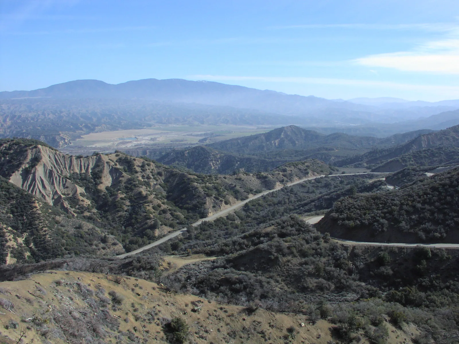
Highway 33 through the Los Padres National ForestPhoto: Antandrus, CC BY-SA 3.0, via Wikimedia Commons
Lockwood Valley and Frazier Park
Lockwood Valley Road is Jeremy's favourite section of the route. It's tight and technical, takes an unusual line through the valley, and the weather can change fast up here, from heavy thunderstorms to snow. Expect dirt and water crossings after rain. After Frazier Park you cross the I-5 at Gorman and head east along Pine Canyon Road.
Camp Scheideck
Camp Scheideck Lodge, 1.5 miles off Lockwood Valley Road, used to be Jeremy's lunch stop. It was built by German immigrants in the 1800s and was a unique place for a burger and a beer. Sadly, the lodge has now closed, so bring food and water for this part of the ride.
Lake Hughes, Castaic and the canyons
At Lake Hughes, the Rock Inn is a popular stop. Lake Hughes Road then drops south past Castaic Lake to Castaic, with some great views. San Francisquito Canyon Road takes you back north into the hills to Green Valley, and Bouquet Canyon Road follows the creek south past Bouquet Reservoir.
Angeles Forest Highway and the Angeles Crest
From Acton, the Angeles Forest Highway climbs over Mill Creek Summit. The route then finishes on the Angeles Crest Highway, dropping down to La Cañada Flintridge above Pasadena.
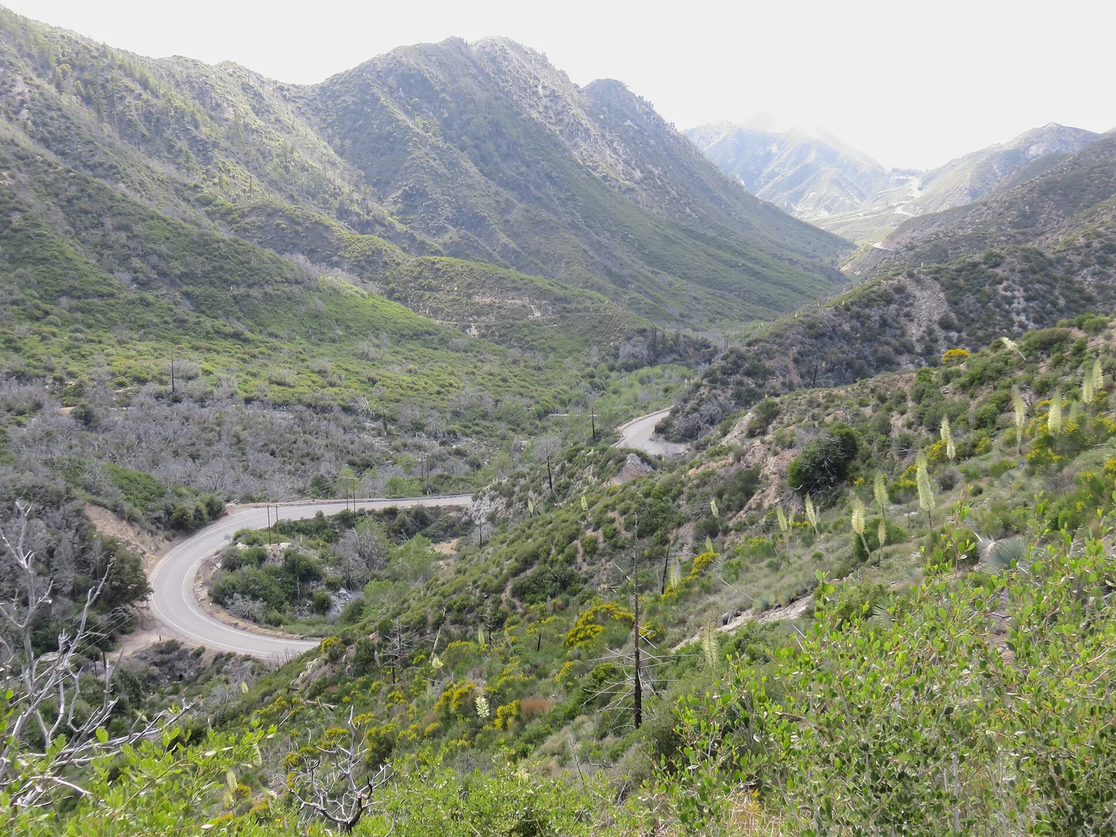
The Angeles Crest Highway in the San Gabriel MountainsPhoto: Antony-22, CC BY-SA 4.0, via Wikimedia Commons
Ride It in Reverse
You can also ride the route from La Cañada Flintridge back to Moorpark, starting on the Angeles Crest. Most navigation apps can reverse a GPX file with one tap.
Waypoints
One GPX track for the whole route, made in Kurviger. It works with Garmin, TomTom, Calimoto, OsmAnd and most other navigation apps. Check the route in your app before you ride.
| Point | Place | What's there |
|---|---|---|
| A | Moorpark | Start in Ventura County |
| B | Santa Paula | Fill up here: fuel gets scarce from now on |
| C | Ojai | Through the orange groves on CA-150 |
| D | Wheeler Gorge | CA-33 starts climbing into the Los Padres |
| E | Camp Scheideck turn | Lockwood Valley Road, Jeremy's old lunch stop |
| F | Lockwood Valley | Jeremy's favourite section of road |
| G | Frazier Park | Over the I-5 towards Gorman |
| H | Lake Hughes | Pine Canyon Road and the Rock Inn |
| I | Castaic | Lake Hughes Road down past Castaic Lake |
| J | Green Valley | Back north on San Francisquito Canyon Road |
| K | Bouquet Reservoir | Bouquet Canyon Road along the creek |
| L | Acton | Onto the Angeles Forest Highway |
| M | Mill Creek Summit | Up through the Angeles National Forest |
| N | Clear Creek | The Angeles Crest Highway |
| O | La Cañada Flintridge | Finish above Pasadena |
Before You Go
- This route isn't for new riders. Much of it is a long way from help, so make sure you and your bike are in good shape.
- Fuel up wherever you can. Petrol stations are few and far between on the mountain sections.
- Check road conditions before you go. At the time of writing, Lockwood Valley Road was listed as closed to residents only, and CA-33, the Angeles Forest Highway and the Angeles Crest can close for rockslides or snow. Check Caltrans QuickMap on the day.
- Expect gravel and water on Lockwood Valley Road after rain.
Android and the file opens as text? Download the ZIP version instead and open it in your Files app to extract the GPX.
Want a route like this built for you?
Tell me where you want to ride, how many days you have and the places you want to see. I'll plan your own route with special stops, route notes and GPX files.
Plan my custom route